Valgatara geodata
Valgatara (Veneto) is a populated place; located in Italy in Europe/Rome (GMT+2) time zone. With population of 1,186 people, there are 6000 cities with bigger population in this country. Compared to other cities in Italy, 74.8% of cities are located further ↓South; 58.3% of cities are located further →East and 57.3% of cities have higher elevation than Valgatara. Note1
Administrative division(s):
- Level 1: Veneto
- Level 2: Provincia di Verona
- Level 3: Marano di Valpolicella


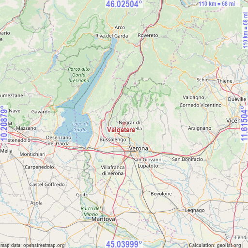
Valgatara GPS coordinates[2]
45° 32' 4.812" North, 10° 54' 42.876" East
| Map corner | latitude | longitude |
|---|---|---|
| Upper-left | 46.02504°, | 10.20879° |
| Center: | 45.53467°, | 10.91191° |
| Lower-right: | 45.03999°, | 11.61504° |
| Map W x H: | 109.5×109.5 km | = 68×68mi |
| max Lat: | 47.04031° ⇑25.2% North |
| Valgatara: | 45.53467° |
| min Lat: | ⇓74.8% South 35.50142° |
| min Long | Valgatara | max Long |
| 6.69888° | 10.91191° | 18.48682° |
| W 41.7%⇐ | ⇒58.3% E |
Elevation
Elevation of Valgatara is 185 m = 607 ft, and this is 121.7 m = 399 ft below average elevation for this country.
| Max E: |
2085 m = 6841 ft | 57.3% |
| Avg. | 306.7 m = 1006 ft | |
| Valgatara | 185 m = 607 ft | |
Min E: |
-4 m = -13 ft | 42.7% |
See also: Italy elevation on elevation.city.
Geographical zone
Valgatara is located in North temperate zone (between Tropic of Cancer and the Arctic Circle). Distance of this North polar circle is 2338.2 km =1452.9 mi to North.| Distance of | km | miles | from Valgatara |
|---|---|---|---|
| North Pole | 4944.1 | 3072.1 | to North |
| Arctic Circle | 2338.2 | 1452.9 | to North |
| Tropic Cancer | 2457.1 | 1526.8 | to South |
| Equator | 5063 | 3146 | to South |


Nearby cities:
15 places around Valgatara: (largest is in red/bold)
• Arbizzano-Santa Maria
4.9 km =3 mi,  155°
155°
• Bure
3.3 km =2.1 mi,  253°
253°
• Corrubbio
5.4 km =3.4 mi,  186°
186°
• Fane
6.4 km =4 mi,  39°
39°
• Fumane
2.2 km =1.4 mi,  290°
290°
• Marano di Valpolicella
2.4 km =1.5 mi,  7°
7°
• Montericco
5.9 km =3.7 mi,  143°
143°
• Negrar
2.2 km =1.4 mi,  106°
106°
• Ospedaletto
6.4 km =4 mi,  238°
238°
• Pedemonte
3.6 km =2.2 mi,  171°
171°
• Pescantina
6.5 km =4 mi,  212°
212°
• San Floriano
1.9 km =1.2 mi, 188°
• San Pietro in Cariano
2.8 km =1.7 mi,  226°
226°
• Sant'Ambrogio di Valpollicella
6.1 km =3.8 mi,  255°
255°
• Settimo
6.2 km =3.9 mi,  182°
182°
Sources, notices
• [Note1] Compared only with cities in Italy existing in our database
• [Src1] Map data: © OpenStreetMap contributors (CC-BY-SA)
• [Src2] Other city data from geonames.org with taken over terms of usage.
• [Src3] Geographical zone / Annual Mean Temperature by Robert A. Rohde @ Wikipedia
