Arbizzano-Santa Maria geodata
Arbizzano-Santa Maria (Veneto) is a populated place; located in Italy in Europe/Rome (GMT+2) time zone. With population of 5,148 people, there are 1901 cities with bigger population in this country. Compared to other cities in Italy, 73.4% of cities are located further ↓South; 58.1% of cities are located further →East and 71.5% of cities have higher elevation than Arbizzano-Santa Maria. Note1
Current local time in Arbizzano-Santa Maria:
08:28 PM, WednesdayDifference from your time zone: hours


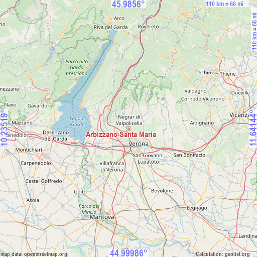
Arbizzano-Santa Maria GPS coordinates[2]
45° 29' 41.604" North, 10° 56' 17.916" East
| Map corner | latitude | longitude |
|---|---|---|
| Upper-left | 45.9856°, | 10.23519° |
| Center: | 45.49489°, | 10.93831° |
| Lower-right: | 44.99986°, | 11.64144° |
| Map W x H: | 109.6×109.6 km | = 68.1×68.1mi |
| max Lat: | 47.04031° ⇑26.6% North |
| Arbizzano-Santa Maria: | 45.49489° |
| min Lat: | ⇓73.4% South 35.50142° |
| min Long | Arbizzano-Santa | max Long |
| 6.69888° | 10.93831° | 18.48682° |
| W 41.9%⇐ | ⇒58.1% E |
Elevation
Elevation of Arbizzano-Santa Maria is 90 m = 295 ft, and this is 216.7 m = 711 ft below average elevation for this country.
| Max E: |
2085 m = 6841 ft | 71.5% |
| Avg. | 306.7 m = 1006 ft | |
| Arbizzano-Santa Maria | 90 m = 295 ft | |
Min E: |
-4 m = -13 ft | 28.5% |
See also: Italy elevation on elevation.city.
Geographical zone
Arbizzano-Santa Maria is located in North temperate zone (between Tropic of Cancer and the Arctic Circle). Distance of this North polar circle is 2342.6 km =1455.6 mi to North.| Distance of | km | miles | from Arbizzano-Santa Maria |
|---|---|---|---|
| North Pole | 4948.5 | 3074.9 | to North |
| Arctic Circle | 2342.6 | 1455.6 | to North |
| Tropic Cancer | 2452.6 | 1524 | to South |
| Equator | 5058.6 | 3143.3 | to South |


Nearby cities:
15 places around Arbizzano-Santa Maria: (largest is in red/bold)
• Bassone
5.9 km =3.7 mi,  215°
215°
• Bure
6.3 km =3.9 mi,  303°
303°
• Corrubbio
2.9 km =1.8 mi,  251°
251°
• Fumane
6.6 km =4.1 mi,  321°
321°
• Montericco
1.5 km =0.9 mi,  102°
102°
• Negrar
3.8 km =2.4 mi,  0°
0°
• Parona
1.8 km =1.1 mi,  165°
165°
• Pedemonte
1.8 km =1.1 mi, 300°
• Pescantina
5.6 km =3.5 mi,  259°
259°
• Poiano
6.8 km =4.2 mi,  113°
113°
• San Floriano
3.5 km =2.2 mi, 317°
• San Pietro in Cariano
4.8 km =3 mi, 301°
• San Vito al Mantico
4.4 km =2.7 mi,  234°
234°
• Settimo
2.9 km =1.8 mi, 232°
• Valgatara
4.9 km =3 mi,  335°
335°
Sources, notices
• [Note1] Compared only with cities in Italy existing in our database
• [Src1] Map data: © OpenStreetMap contributors (CC-BY-SA)
• [Src2] Other city data from geonames.org with taken over terms of usage.
• [Src3] Geographical zone / Annual Mean Temperature by Robert A. Rohde @ Wikipedia
