Poggetto geodata
Poggetto (Tuscany) is a populated place; located in Italy in Europe/Rome (GMT+2) time zone. With population of 1,588 people, there are 4929 cities with bigger population in this country. Compared to other cities in Italy, 56.7% of cities are located further ↑North; 56.7% of cities are located further →East and 82% of cities have higher elevation than Poggetto. Note1


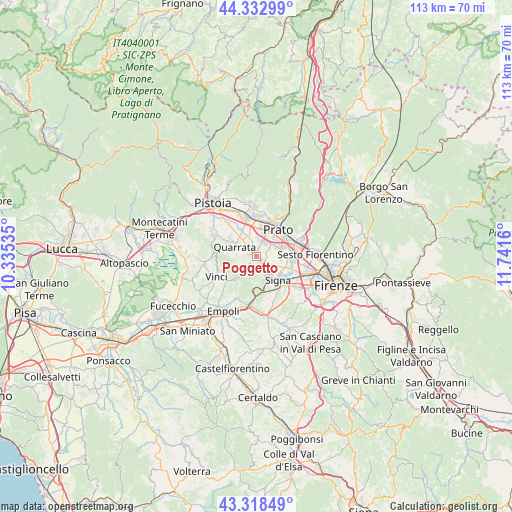
Poggetto GPS coordinates[2]
43° 49' 40.44" North, 11° 2' 18.492" East
| Map corner | latitude | longitude |
|---|---|---|
| Upper-left | 44.33299°, | 10.33535° |
| Center: | 43.8279°, | 11.03847° |
| Lower-right: | 43.31849°, | 11.7416° |
| Map W x H: | 112.8×112.8 km | = 70.1×70.1mi |
| max Lat: | 47.04031° ⇑56.7% North |
| Poggetto: | 43.8279° |
| min Lat: | ⇓43.3% South 35.50142° |
| min Long | Poggetto | max Long |
| 6.69888° | 11.03847° | 18.48682° |
| W 43.3%⇐ | ⇒56.7% E |
Elevation
Elevation of Poggetto is 42 m = 138 ft, and this is 264.7 m = 868 ft below average elevation for this country.
| Max E: |
2085 m = 6841 ft | 82% |
| Avg. | 306.7 m = 1006 ft | |
| Poggetto | 42 m = 138 ft | |
Min E: |
-4 m = -13 ft | 18% |
See also: Italy elevation on elevation.city.
Geographical zone
Poggetto is located in North temperate zone (between Tropic of Cancer and the Arctic Circle). Distance of this Northern Tropic circle is 2267.3 km =1408.8 mi to South.| Distance of | km | miles | from Poggetto |
|---|---|---|---|
| North Pole | 5133.9 | 3190.1 | to North |
| Arctic Circle | 2528 | 1570.8 | to North |
| Tropic Cancer | 2267.3 | 1408.8 | to South |
| Equator | 4873.2 | 3028.1 | to South |


Nearby cities:
15 places around Poggetto: (largest is in red/bold)
• Campi Bisenzio
7.4 km =4.6 mi,  92°
92°
• Carmignano
2.7 km =1.7 mi,  223°
223°
• Caserana
4.5 km =2.8 mi,  333°
333°
• Casini
4.6 km =2.9 mi,  317°
317°
• Catena
2.4 km =1.5 mi,  312°
312°
• Comeana
4.2 km =2.6 mi,  157°
157°
• Poggio A Caiano
1.9 km =1.2 mi,  145°
145°
• Prato
7.5 km =4.7 mi,  38°
38°
• Quarrata
5.3 km =3.3 mi,  295°
295°
• San Mauro
7.9 km =4.9 mi,  118°
118°
• Seano
1.4 km =0.9 mi,  281°
281°
• Serra
2.9 km =1.8 mi,  192°
192°
• Signa
6.4 km =4 mi,  125°
125°
• Valenzatico
7.3 km =4.5 mi, 306°
• Vignole-Olmi
5.8 km =3.6 mi, 318°
Sources, notices
• [Note1] Compared only with cities in Italy existing in our database
• [Src1] Map data: © OpenStreetMap contributors (CC-BY-SA)
• [Src2] Other city data from geonames.org with taken over terms of usage.
• [Src3] Geographical zone / Annual Mean Temperature by Robert A. Rohde @ Wikipedia
