Porto Santa Margherita geodata
Porto Santa Margherita (Veneto) is a populated place; located in Italy in Europe/Rome (GMT+2) time zone. With population of 812 people, there are 7589 cities with bigger population in this country. Compared to other cities in Italy, 76.6% of cities are located further ↓South; 66.7% of cities are located further ←West and 99% of cities have higher elevation than Porto Santa Margherita. Note1
Current local time in Porto Santa Margherita:
10:43 PM, WednesdayDifference from your time zone: hours


Porto Santa Margherita GPS coordinates[2]
45° 35' 20.76" North, 12° 51' 29.484" East
| Map corner | latitude | longitude |
|---|---|---|
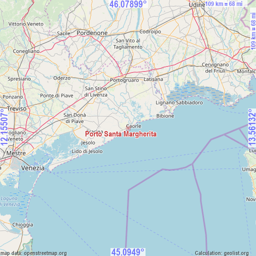
| Upper-left | 46.07899°, | 12.15507° |
| Center: | 45.5891°, | 12.85819° |
| Lower-right: | 45.0949°, | 13.56132° |
| Map W x H: | 109.4×109.4 km | = 68×68mi |
| max Lat: | 47.04031° ⇑23.4% North |
| Porto Santa Margherita: | 45.5891° |
| min Lat: | ⇓76.6% South 35.50142° |
| min Long | Porto Santa Mar | max Long |
| 6.69888° | 12.85819° | 18.48682° |
| W 66.7%⇐ | ⇒33.3% E |
Elevation
Elevation of Porto Santa Margherita is 2 m = 7 ft, and this is 304.7 m = 1000 ft below average elevation for this country.
| Max E: |
2085 m = 6841 ft | 99% |
| Avg. | 306.7 m = 1006 ft | |
| Porto Santa Margherita | 2 m = 7 ft | |
Min E: |
-4 m = -13 ft | 1% |
See also: Italy elevation on elevation.city.
Geographical zone
Porto Santa Margherita is located in North temperate zone (between Tropic of Cancer and the Arctic Circle). Distance of this North polar circle is 2332.1 km =1449.1 mi to North.| Distance of | km | miles | from Porto Santa Margherita |
|---|---|---|---|
| North Pole | 4938 | 3068.3 | to North |
| Arctic Circle | 2332.1 | 1449.1 | to North |
| Tropic Cancer | 2463.1 | 1530.5 | to South |
| Equator | 5069 | 3149.7 | to South |


Nearby cities:
15 places around Porto Santa Margherita: (largest is in red/bold)
• Bibione
14.8 km =9.2 mi,  69°
69°
• Caorle
1.6 km =1 mi,  58°
58°
• Cesarolo
18.9 km =11.7 mi,  40°
40°
• Concordia Sagittaria
19.3 km =12 mi,  352°
352°
• Crepaldo
12.6 km =7.8 mi,  272°
272°
• Eraclea
14.5 km =9 mi,  264°
264°
• Iesolo
17.7 km =11 mi,  249°
249°
• La Salute di Livenza
8.4 km =5.2 mi,  328°
328°
• Lido di Jesolo
18.8 km =11.7 mi,  240°
240°
• Lugugnana
17.8 km =11.1 mi,  26°
26°
• San Giorgio di Livenza
8.6 km =5.3 mi, 326°
• Sindacale
12.8 km =8 mi,  6°
6°
• Stretti
14.2 km =8.8 mi,  291°
291°
• Torre di Fine
8.8 km =5.5 mi, 253°
• Torre di Mosto
16.4 km =10.2 mi,  311°
311°
Sources, notices
• [Note1] Compared only with cities in Italy existing in our database
• [Src1] Map data: © OpenStreetMap contributors (CC-BY-SA)
• [Src2] Other city data from geonames.org with taken over terms of usage.
• [Src3] Geographical zone / Annual Mean Temperature by Robert A. Rohde @ Wikipedia
