Bibione geodata
Bibione (Veneto) is a populated place; located in Italy in Europe/Rome (GMT+2) time zone. With population of 2,564 people, there are 3447 cities with bigger population in this country. Compared to other cities in Italy, 78.5% of cities are located further ↓South; 68.7% of cities are located further ←West and 97.2% of cities have higher elevation than Bibione. Note1
Administrative division(s):
- Level 1: Veneto
- Level 2: Provincia di Venezia
- Level 3: San Michele al Tagliamento


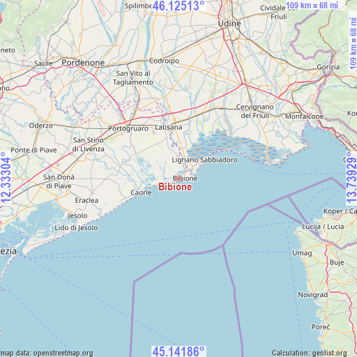
Bibione GPS coordinates[2]
45° 38' 8.34" North, 13° 2' 10.176" East
| Map corner | latitude | longitude |
|---|---|---|
| Upper-left | 46.12513°, | 12.33304° |
| Center: | 45.63565°, | 13.03616° |
| Lower-right: | 45.14186°, | 13.73929° |
| Map W x H: | 109.3×109.3 km | = 67.9×67.9mi |
| max Lat: | 47.04031° ⇑21.5% North |
| Bibione: | 45.63565° |
| min Lat: | ⇓78.5% South 35.50142° |
| min Long | Bibione | max Long |
| 6.69888° | 13.03616° | 18.48682° |
| W 68.7%⇐ | ⇒31.3% E |
Elevation
Elevation of Bibione is 5 m = 16 ft, and this is 301.7 m = 990 ft below average elevation for this country.
| Max E: |
2085 m = 6841 ft | 97.2% |
| Avg. | 306.7 m = 1006 ft | |
| Bibione | 5 m = 16 ft | |
Min E: |
-4 m = -13 ft | 2.8% |
See also: Italy elevation on elevation.city.
Geographical zone
Bibione is located in North temperate zone (between Tropic of Cancer and the Arctic Circle). Distance of this North polar circle is 2327 km =1445.9 mi to North.| Distance of | km | miles | from Bibione |
|---|---|---|---|
| North Pole | 4932.9 | 3065.2 | to North |
| Arctic Circle | 2327 | 1445.9 | to North |
| Tropic Cancer | 2468.3 | 1533.7 | to South |
| Equator | 5074.2 | 3153 | to South |


Nearby cities:
15 places around Bibione: (largest is in red/bold)
• Caorle
13.2 km =8.2 mi,  250°
250°
• Cesarolo
9.4 km =5.8 mi,  350°
350°
• Gorgo
12.4 km =7.7 mi,  355°
355°
• La Salute di Livenza
18.4 km =11.4 mi,  276°
276°
• Latisana
15 km =9.3 mi, 351°
• Lignano Sabbiadoro
7.7 km =4.8 mi,  54°
54°
• Lugugnana
12.3 km =7.6 mi,  331°
331°
• Marano Lagunare
17.5 km =10.9 mi,  35°
35°
• Palazzolo dello Stella
18.5 km =11.5 mi,  12°
12°
• Pertegada
9.6 km =6 mi,  3°
3°
• Porto Santa Margherita
14.8 km =9.2 mi, 249°
• Precenicco
18.2 km =11.3 mi, 9°
• San Michele al Tagliamento
14.7 km =9.1 mi, 347°
• Sindacale
14.5 km =9 mi,  301°
301°
• Villanova Santa Margherita
18.3 km =11.4 mi,  323°
323°
Sources, notices
• [Note1] Compared only with cities in Italy existing in our database
• [Src1] Map data: © OpenStreetMap contributors (CC-BY-SA)
• [Src2] Other city data from geonames.org with taken over terms of usage.
• [Src3] Geographical zone / Annual Mean Temperature by Robert A. Rohde @ Wikipedia
