Rogoredo-Valaperta-Rimoldo geodata
Rogoredo-Valaperta-Rimoldo (Lombardy) is a populated place; located in Italy in Europe/Rome (GMT+2) time zone. With population of 4,322 people, there are 2227 cities with bigger population in this country. Compared to other cities in Italy, 80.2% of cities are located further ↓South; 75.8% of cities are located further →East and 57.1% of cities have lower elevation than Rogoredo-Valaperta-Rimoldo. Note1
Current local time in Rogoredo-Valaperta-Rimoldo:
05:04 PM, WednesdayDifference from your time zone: hours


Rogoredo-Valaperta-Rimoldo GPS coordinates[2]
45° 40' 37.02" North, 9° 19' 57.972" East
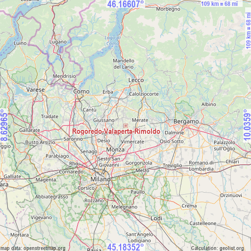
| Map corner | latitude | longitude |
|---|---|---|
| Upper-left | 46.16607°, | 8.62965° |
| Center: | 45.67695°, | 9.33277° |
| Lower-right: | 45.18352°, | 10.0359° |
| Map W x H: | 109.2×109.2 km | = 67.9×67.9mi |
| max Lat: | 47.04031° ⇑19.8% North |
| Rogoredo-Valaperta-Rimoldo: | 45.67695° |
| min Lat: | ⇓80.2% South 35.50142° |
| min Long | Rogoredo-Valape | max Long |
| 6.69888° | 9.33277° | 18.48682° |
| W 24.2%⇐ | ⇒75.8% E |
Elevation
Elevation of Rogoredo-Valaperta-Rimoldo is 279 m = 915 ft, and this is 27.7 m = 91 ft below average elevation for this country.
| Max E: |
2085 m = 6841 ft | 42.9% |
| Avg. | 306.7 m = 1006 ft | |
| Rogoredo-Valaperta-Rimoldo | 279 m = 915 ft | |
Min E: |
-4 m = -13 ft | 57.1% |
See also: Italy elevation on elevation.city.
Geographical zone
Rogoredo-Valaperta-Rimoldo is located in North temperate zone (between Tropic of Cancer and the Arctic Circle). Distance of this North polar circle is 2322.4 km =1443.1 mi to North.| Distance of | km | miles | from Rogoredo-Valaperta-Rimoldo |
|---|---|---|---|
| North Pole | 4928.3 | 3062.3 | to North |
| Arctic Circle | 2322.4 | 1443.1 | to North |
| Tropic Cancer | 2472.9 | 1536.6 | to South |
| Equator | 5078.8 | 3155.8 | to South |


Nearby cities:
15 places around Rogoredo-Valaperta-Rimoldo: (largest is in red/bold)
• Besana in Brianza
4.1 km =2.5 mi,  313°
313°
• Camparada
2.6 km =1.6 mi,  196°
196°
• Campofiorenzo-California
1.6 km =1 mi,  229°
229°
• Canonica
4.2 km =2.6 mi,  236°
236°
• Casatenovo
2.5 km =1.6 mi,  323°
323°
• Correzzana
2.3 km =1.4 mi, 239°
• Lesmo
3.7 km =2.3 mi,  212°
212°
• Lomagna
3.6 km =2.2 mi,  109°
109°
• Lomaniga
3.5 km =2.2 mi,  33°
33°
• Maresso
2.2 km =1.4 mi,  56°
56°
• Missaglia
3.3 km =2.1 mi,  2°
2°
• Monticello Brianza
3.9 km =2.4 mi,  339°
339°
• Quattro Strade
4 km =2.5 mi, 58°
• Tregasio
3.5 km =2.2 mi,  271°
271°
• Usmate-Velate
4 km =2.5 mi,  144°
144°
Sources, notices
• [Note1] Compared only with cities in Italy existing in our database
• [Src1] Map data: © OpenStreetMap contributors (CC-BY-SA)
• [Src2] Other city data from geonames.org with taken over terms of usage.
• [Src3] Geographical zone / Annual Mean Temperature by Robert A. Rohde @ Wikipedia
