Castelnovo geodata
Castelnovo (Veneto) is a populated place; located in Italy in Europe/Rome (GMT+2) time zone. With population of 3,229 people, there are 2880 cities with bigger population in this country. Compared to other cities in Italy, 77.8% of cities are located further ↓South; 51% of cities are located further →East and 76.8% of cities have higher elevation than Castelnovo. Note1


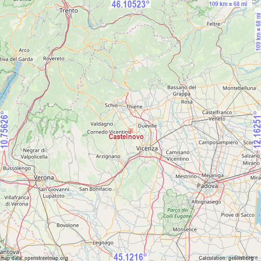
Castelnovo GPS coordinates[2]
45° 36' 56.052" North, 11° 27' 33.768" East
| Map corner | latitude | longitude |
|---|---|---|
| Upper-left | 46.10523°, | 10.75626° |
| Center: | 45.61557°, | 11.45938° |
| Lower-right: | 45.1216°, | 12.16251° |
| Map W x H: | 109.4×109.4 km | = 68×68mi |
| max Lat: | 47.04031° ⇑22.2% North |
| Castelnovo: | 45.61557° |
| min Lat: | ⇓77.8% South 35.50142° |
| min Long | Castelnovo | max Long |
| 6.69888° | 11.45938° | 18.48682° |
| W 49%⇐ | ⇒51% E |
Elevation
Elevation of Castelnovo is 65 m = 213 ft, and this is 241.7 m = 793 ft below average elevation for this country.
| Max E: |
2085 m = 6841 ft | 76.8% |
| Avg. | 306.7 m = 1006 ft | |
| Castelnovo | 65 m = 213 ft | |
Min E: |
-4 m = -13 ft | 23.2% |
See also: Italy elevation on elevation.city.
Geographical zone
Castelnovo is located in North temperate zone (between Tropic of Cancer and the Arctic Circle). Distance of this North polar circle is 2329.2 km =1447.3 mi to North.| Distance of | km | miles | from Castelnovo |
|---|---|---|---|
| North Pole | 4935.1 | 3066.5 | to North |
| Arctic Circle | 2329.2 | 1447.3 | to North |
| Tropic Cancer | 2466.1 | 1532.4 | to South |
| Equator | 5072 | 3151.6 | to South |


Nearby cities:
15 places around Castelnovo: (largest is in red/bold)
• Caldogno-Rettorgole-Cresole
3.5 km =2.2 mi,  104°
104°
• Castelgomberto
6.5 km =4 mi,  235°
235°
• Cereda-Cozza Cornedo
7.3 km =4.5 mi,  257°
257°
• Costabissara
4.2 km =2.6 mi,  151°
151°
• Crispi Cavour
5 km =3.1 mi,  139°
139°
• Dueville
7.5 km =4.7 mi,  72°
72°
• Gambugliano
3.5 km =2.2 mi,  207°
207°
• Isola Vicentina
1.8 km =1.1 mi,  325°
325°
• Malo
5.9 km =3.7 mi, 325°
• Monteviale
6.3 km =3.9 mi,  181°
181°
• Motta
3.7 km =2.3 mi,  126°
126°
• Novoledo
5.2 km =3.2 mi,  48°
48°
• Santo
6.9 km =4.3 mi,  18°
18°
• Valle
4.9 km =3 mi,  228°
228°
• Villaverla
4.5 km =2.8 mi,  33°
33°
Sources, notices
• [Note1] Compared only with cities in Italy existing in our database
• [Src1] Map data: © OpenStreetMap contributors (CC-BY-SA)
• [Src2] Other city data from geonames.org with taken over terms of usage.
• [Src3] Geographical zone / Annual Mean Temperature by Robert A. Rohde @ Wikipedia
