Scandiano geodata
Scandiano (Emilia-Romagna) is a seat of a third-order administrative division; located in Italy in Europe/Rome (GMT+2) time zone. With population of 11,010 people, there are 857 cities with bigger population in this country. Compared to other cities in Italy, 52.4% of cities are located further ↓South; 60.9% of cities are located further →East and 70.4% of cities have higher elevation than Scandiano. Note1
Administrative division(s):
- Level 1: Emilia-Romagna
- Level 2: Provincia di Reggio Emilia
- Level 3: Scandiano


Scandiano GPS coordinates[2]
44° 35' 53.88" North, 10° 41' 44.088" East
| Map corner | latitude | longitude |
|---|---|---|
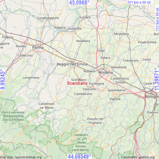
| Upper-left | 45.0968°, | 9.99245° |
| Center: | 44.5983°, | 10.69558° |
| Lower-right: | 44.09549°, | 11.39871° |
| Map W x H: | 111.3×111.3 km | = 69.2×69.2mi |
| max Lat: | 47.04031° ⇑47.6% North |
| Scandiano: | 44.5983° |
| min Lat: | ⇓52.4% South 35.50142° |
| min Long | Scandiano | max Long |
| 6.69888° | 10.69558° | 18.48682° |
| W 39.1%⇐ | ⇒60.9% E |
Elevation
Elevation of Scandiano is 95 m = 312 ft, and this is 211.7 m = 695 ft below average elevation for this country.
| Max E: |
2085 m = 6841 ft | 70.4% |
| Avg. | 306.7 m = 1006 ft | |
| Scandiano | 95 m = 312 ft | |
Min E: |
-4 m = -13 ft | 29.6% |
See also: Italy elevation on elevation.city.
Geographical zone
Scandiano is located in North temperate zone (between Tropic of Cancer and the Arctic Circle). Distance of this Northern Tropic circle is 2352.9 km =1462 mi to South.| Distance of | km | miles | from Scandiano |
|---|---|---|---|
| North Pole | 5048.2 | 3136.8 | to North |
| Arctic Circle | 2442.3 | 1517.6 | to North |
| Tropic Cancer | 2352.9 | 1462 | to South |
| Equator | 4958.9 | 3081.3 | to South |


Nearby cities:
15 places around Scandiano: (largest is in red/bold)
• Albinea
7.5 km =4.7 mi,  296°
296°
• Arceto
3.1 km =1.9 mi,  46°
46°
• Borzano
4.7 km =2.9 mi,  277°
277°
• Bosco
3.3 km =2.1 mi,  324°
324°
• Ca' de' Caroli
2 km =1.2 mi,  235°
235°
• Cadiroggio
6.6 km =4.1 mi,  145°
145°
• Casalgrande
3.5 km =2.2 mi,  115°
115°
• Corticella
6 km =3.7 mi, 47°
• Fellegara
1.4 km =0.9 mi,  4°
4°
• Fogliano
6.8 km =4.2 mi, 323°
• Gavasseto
6.4 km =4 mi,  346°
346°
• Pratissolo
1.8 km =1.1 mi,  290°
290°
• Salvaterra
5.8 km =3.6 mi,  88°
88°
• Veggia-Villalunga
6.4 km =4 mi,  131°
131°
• Ventoso
1.5 km =0.9 mi,  204°
204°
Sources, notices
• [Note1] Compared only with cities in Italy existing in our database
• [Src1] Map data: © OpenStreetMap contributors (CC-BY-SA)
• [Src2] Other city data from geonames.org with taken over terms of usage.
• [Src3] Geographical zone / Annual Mean Temperature by Robert A. Rohde @ Wikipedia
