Bandito geodata
Bandito (Piedmont) is a populated place; located in Italy in Europe/Rome (GMT+2) time zone. With population of 2,164 people, there are 3917 cities with bigger population in this country. Compared to other cities in Italy, 54.7% of cities are located further ↓South; 95.3% of cities are located further →East and 57.6% of cities have lower elevation than Bandito. Note1


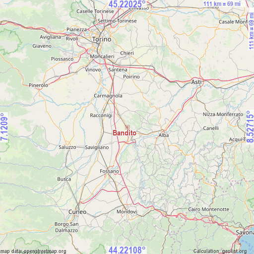
Bandito GPS coordinates[2]
44° 43' 22.152" North, 7° 49' 26.508" East
| Map corner | latitude | longitude |
|---|---|---|
| Upper-left | 45.22025°, | 7.1209° |
| Center: | 44.72282°, | 7.82403° |
| Lower-right: | 44.22108°, | 8.52715° |
| Map W x H: | 111.1×111.1 km | = 69×69mi |
| max Lat: | 47.04031° ⇑45.3% North |
| Bandito: | 44.72282° |
| min Lat: | ⇓54.7% South 35.50142° |
| min Long | Bandito | max Long |
| 6.69888° | 7.82403° | 18.48682° |
| W 4.7%⇐ | ⇒95.3% E |
Elevation
Elevation of Bandito is 283 m = 928 ft, and this is 23.7 m = 78 ft below average elevation for this country.
| Max E: |
2085 m = 6841 ft | 42.4% |
| Avg. | 306.7 m = 1006 ft | |
| Bandito | 283 m = 928 ft | |
Min E: |
-4 m = -13 ft | 57.6% |
See also: Italy elevation on elevation.city.
Geographical zone
Bandito is located in North temperate zone (between Tropic of Cancer and the Arctic Circle). Distance of this Northern Tropic circle is 2366.8 km =1470.7 mi to South.| Distance of | km | miles | from Bandito |
|---|---|---|---|
| North Pole | 5034.4 | 3128.2 | to North |
| Arctic Circle | 2428.5 | 1509 | to North |
| Tropic Cancer | 2366.8 | 1470.7 | to South |
| Equator | 4972.7 | 3089.9 | to South |


Nearby cities:
15 places around Bandito: (largest is in red/bold)
• Baldissero d'Alba
8 km =5 mi,  57°
57°
• Borgo San Martino
5.6 km =3.5 mi,  116°
116°
• Bra
3.5 km =2.2 mi,  142°
142°
• Bricco Favole
7.6 km =4.7 mi,  187°
187°
• Ceresole Alba
8.6 km =5.3 mi,  359°
359°
• Cherasco
9.2 km =5.7 mi,  162°
162°
• Cinzano
8.3 km =5.2 mi,  113°
113°
• Pocapaglia
4.7 km =2.9 mi,  100°
100°
• Pollenzo
6.9 km =4.3 mi,  125°
125°
• Roreto
6 km =3.7 mi,  172°
172°
• Sanfrè
3.6 km =2.2 mi,  332°
332°
• Sommariva Perno
6.6 km =4.1 mi,  67°
67°
• Sommariva del Bosco
6.5 km =4 mi, 328°
• Villa
6.6 km =4.1 mi, 66°
• Villa-Borgo
9.2 km =5.7 mi, 107°
Sources, notices
• [Note1] Compared only with cities in Italy existing in our database
• [Src1] Map data: © OpenStreetMap contributors (CC-BY-SA)
• [Src2] Other city data from geonames.org with taken over terms of usage.
• [Src3] Geographical zone / Annual Mean Temperature by Robert A. Rohde @ Wikipedia
