Fossa geodata
Fossa (Emilia-Romagna) is a populated place; located in Italy in Europe/Rome (GMT+2) time zone. With population of 1,344 people, there are 5501 cities with bigger population in this country. Compared to other cities in Italy, 58.4% of cities are located further ↓South; 57% of cities are located further →East and 90.6% of cities have higher elevation than Fossa. Note1
Administrative division(s):
- Level 1: Emilia-Romagna
- Level 2: Provincia di Modena
- Level 3: Concordia sulla Secchia


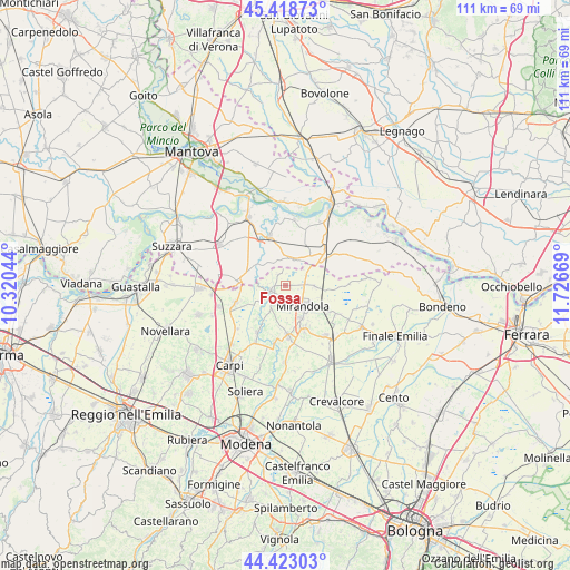
Fossa GPS coordinates[2]
44° 55' 22.944" North, 11° 1' 24.816" East
| Map corner | latitude | longitude |
|---|---|---|
| Upper-left | 45.41873°, | 10.32044° |
| Center: | 44.92304°, | 11.02356° |
| Lower-right: | 44.42303°, | 11.72669° |
| Map W x H: | 110.7×110.7 km | = 68.8×68.8mi |
| max Lat: | 47.04031° ⇑41.6% North |
| Fossa: | 44.92304° |
| min Lat: | ⇓58.4% South 35.50142° |
| min Long | Fossa | max Long |
| 6.69888° | 11.02356° | 18.48682° |
| W 43%⇐ | ⇒57% E |
Elevation
Elevation of Fossa is 17 m = 56 ft, and this is 289.7 m = 950 ft below average elevation for this country.
| Max E: |
2085 m = 6841 ft | 90.6% |
| Avg. | 306.7 m = 1006 ft | |
| Fossa | 17 m = 56 ft | |
Min E: |
-4 m = -13 ft | 9.4% |
See also: Italy elevation on elevation.city.
Geographical zone
Fossa is located in North temperate zone (between Tropic of Cancer and the Arctic Circle). Distance of this Northern Tropic circle is 2389.1 km =1484.5 mi to South.| Distance of | km | miles | from Fossa |
|---|---|---|---|
| North Pole | 5012.1 | 3114.4 | to North |
| Arctic Circle | 2406.2 | 1495.1 | to North |
| Tropic Cancer | 2389.1 | 1484.5 | to South |
| Equator | 4995 | 3103.7 | to South |


Nearby cities:
15 places around Fossa: (largest is in red/bold)
• Bondanello
7.3 km =4.5 mi,  303°
303°
• Cavezzo
9.8 km =6.1 mi,  177°
177°
• Concordia sulla Secchia
3 km =1.9 mi,  247°
247°
• Medolla
9.2 km =5.7 mi,  157°
157°
• Mirandola
5.5 km =3.4 mi,  139°
139°
• Moglia
8.7 km =5.4 mi,  279°
279°
• Poggio Rusco
8 km =5 mi,  52°
52°
• Quarantoli
6.3 km =3.9 mi,  93°
93°
• Quistello
9.9 km =6.2 mi,  341°
341°
• San Biagio
10.4 km =6.5 mi,  131°
131°
• San Giacomo delle Segnate
5.7 km =3.5 mi,  8°
8°
• San Giovanni del Dosso
6.6 km =4.1 mi,  43°
43°
• San Possidonio
6.4 km =4 mi,  211°
211°
• Schivenoglia
8.9 km =5.5 mi,  25°
25°
• Vallalta
2.6 km =1.6 mi,  329°
329°
Sources, notices
• [Note1] Compared only with cities in Italy existing in our database
• [Src1] Map data: © OpenStreetMap contributors (CC-BY-SA)
• [Src2] Other city data from geonames.org with taken over terms of usage.
• [Src3] Geographical zone / Annual Mean Temperature by Robert A. Rohde @ Wikipedia
