Costa-Barco geodata
Costa-Barco (Lombardy) is a populated place; located in Italy in Europe/Rome (GMT+2) time zone. With population of 1,319 people, there are 5576 cities with bigger population in this country. Compared to other cities in Italy, 76.4% of cities are located further ↓South; 67.4% of cities are located further →East and 56.4% of cities have higher elevation than Costa-Barco. Note1
Administrative division(s):
- Level 1: Lombardy
- Level 2: Provincia di Brescia
- Level 3: Cazzago San Martino


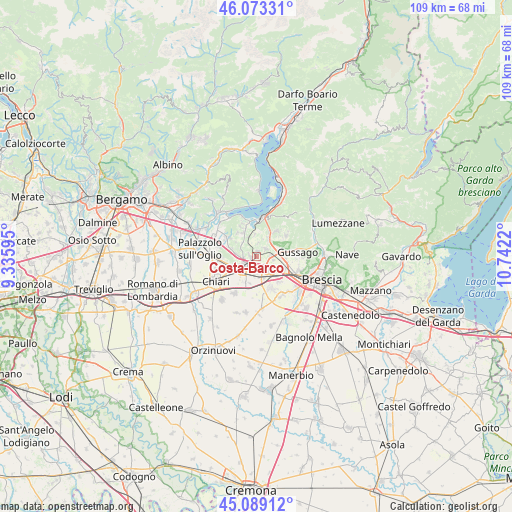
Costa-Barco GPS coordinates[2]
45° 35' 0.132" North, 10° 2' 20.652" East
| Map corner | latitude | longitude |
|---|---|---|
| Upper-left | 46.07331°, | 9.33595° |
| Center: | 45.58337°, | 10.03907° |
| Lower-right: | 45.08912°, | 10.7422° |
| Map W x H: | 109.4×109.4 km | = 68×68mi |
| max Lat: | 47.04031° ⇑23.6% North |
| Costa-Barco: | 45.58337° |
| min Lat: | ⇓76.4% South 35.50142° |
| min Long | Costa-Barco | max Long |
| 6.69888° | 10.03907° | 18.48682° |
| W 32.6%⇐ | ⇒67.4% E |
Elevation
Elevation of Costa-Barco is 192 m = 630 ft, and this is 114.7 m = 376 ft below average elevation for this country.
| Max E: |
2085 m = 6841 ft | 56.4% |
| Avg. | 306.7 m = 1006 ft | |
| Costa-Barco | 192 m = 630 ft | |
Min E: |
-4 m = -13 ft | 43.6% |
See also: Italy elevation on elevation.city.
Geographical zone
Costa-Barco is located in North temperate zone (between Tropic of Cancer and the Arctic Circle). Distance of this North polar circle is 2332.8 km =1449.5 mi to North.| Distance of | km | miles | from Costa-Barco |
|---|---|---|---|
| North Pole | 4938.7 | 3068.8 | to North |
| Arctic Circle | 2332.8 | 1449.5 | to North |
| Tropic Cancer | 2462.5 | 1530.1 | to South |
| Equator | 5068.4 | 3149.4 | to South |


Nearby cities:
15 places around Costa-Barco: (largest is in red/bold)
• Borgonato
4.5 km =2.8 mi,  338°
338°
• Bornato
1.2 km =0.7 mi,  7°
7°
• Cazzago San Martino-Calino
1.2 km =0.7 mi,  275°
275°
• Erbusco
5.5 km =3.4 mi,  288°
288°
• Fontane-Zurane-Gresine
5.6 km =3.5 mi, 6°
• Lodetto
3.6 km =2.2 mi,  188°
188°
• Monterotondo
2.9 km =1.8 mi, 6°
• Ospitaletto
4.5 km =2.8 mi,  140°
140°
• Paderno Franciacorta
3.2 km =2 mi,  82°
82°
• Passirano
2.8 km =1.7 mi,  58°
58°
• Ponte Cingoli
5.5 km =3.4 mi,  73°
73°
• Rovato
3.6 km =2.2 mi,  232°
232°
• Segabiello
4.5 km =2.8 mi,  173°
173°
• Torbiato
5.4 km =3.4 mi,  306°
306°
• Villa Pedergnano
3.5 km =2.2 mi,  273°
273°
Sources, notices
• [Note1] Compared only with cities in Italy existing in our database
• [Src1] Map data: © OpenStreetMap contributors (CC-BY-SA)
• [Src2] Other city data from geonames.org with taken over terms of usage.
• [Src3] Geographical zone / Annual Mean Temperature by Robert A. Rohde @ Wikipedia
