Inverno e Monteleone geodata
Inverno e Monteleone (Lombardy) is a seat of a third-order administrative division; located in Italy in Europe/Rome (GMT+2) time zone. With population of 1,069 people, there are 6404 cities with bigger population in this country. Compared to other cities in Italy, 64.9% of cities are located further ↓South; 74.7% of cities are located further →East and 74.5% of cities have higher elevation than Inverno e Monteleone. Note1
Administrative division(s):
- Level 1: Lombardy
- Level 2: Provincia di Pavia
- Level 3: Inverno e Monteleone
Current local time in Inverno e Monteleone:
07:29 PM, WednesdayDifference from your time zone: hours


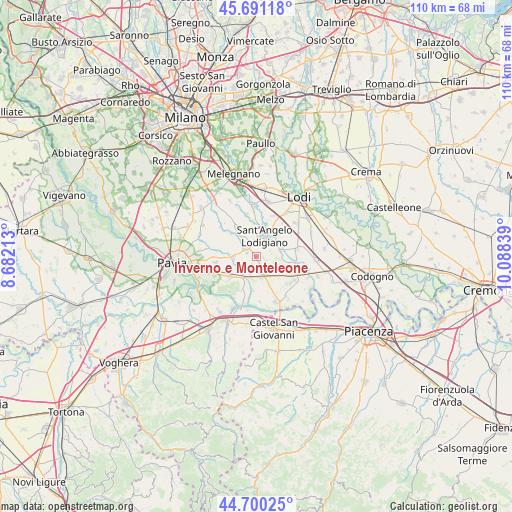
Inverno e Monteleone GPS coordinates[2]
45° 11' 52.332" North, 9° 23' 6.936" East
| Map corner | latitude | longitude |
|---|---|---|
| Upper-left | 45.69118°, | 8.68213° |
| Center: | 45.19787°, | 9.38526° |
| Lower-right: | 44.70025°, | 10.08839° |
| Map W x H: | 110.2×110.2 km | = 68.5×68.5mi |
| max Lat: | 47.04031° ⇑35.1% North |
| Inverno e Monteleone: | 45.19787° |
| min Lat: | ⇓64.9% South 35.50142° |
| min Long | Inverno e Monte | max Long |
| 6.69888° | 9.38526° | 18.48682° |
| W 25.3%⇐ | ⇒74.7% E |
Elevation
Elevation of Inverno e Monteleone is 76 m = 249 ft, and this is 230.7 m = 757 ft below average elevation for this country.
| Max E: |
2085 m = 6841 ft | 74.5% |
| Avg. | 306.7 m = 1006 ft | |
| Inverno e Monteleone | 76 m = 249 ft | |
Min E: |
-4 m = -13 ft | 25.5% |
See also: Italy elevation on elevation.city.
Geographical zone
Inverno e Monteleone is located in North temperate zone (between Tropic of Cancer and the Arctic Circle). Distance of this North polar circle is 2375.6 km =1476.1 mi to North.| Distance of | km | miles | from Inverno e Monteleone |
|---|---|---|---|
| North Pole | 4981.5 | 3095.4 | to North |
| Arctic Circle | 2375.6 | 1476.1 | to North |
| Tropic Cancer | 2419.6 | 1503.5 | to South |
| Equator | 5025.5 | 3122.7 | to South |


Nearby cities:
15 places around Inverno e Monteleone: (largest is in red/bold)
• Copiano
4.8 km =3 mi,  269°
269°
• Corteolona
4.6 km =2.9 mi,  193°
193°
• Filighera
6 km =3.7 mi,  244°
244°
• Genzone
3.5 km =2.2 mi,  234°
234°
• Gerenzago
2.1 km =1.3 mi,  296°
296°
• Graffignana
5.5 km =3.4 mi,  79°
79°
• Inverno
0.1 km =0.1 mi,  316°
316°
• Magherno
5.2 km =3.2 mi, 303°
• Marudo
6.2 km =3.9 mi,  354°
354°
• Miradolo Terme
5.5 km =3.4 mi,  122°
122°
• Monteleone
1.9 km =1.2 mi,  103°
103°
• Sant'Angelo Lodigiano
4.5 km =2.8 mi,  21°
21°
• Santa Cristina
4.6 km =2.9 mi,  165°
165°
• Villanterio
2.9 km =1.8 mi, 319°
• Vistarino
6.2 km =3.9 mi,  283°
283°
Sources, notices
• [Note1] Compared only with cities in Italy existing in our database
• [Src1] Map data: © OpenStreetMap contributors (CC-BY-SA)
• [Src2] Other city data from geonames.org with taken over terms of usage.
• [Src3] Geographical zone / Annual Mean Temperature by Robert A. Rohde @ Wikipedia
