Strada geodata
Strada (Tuscany) is a seat of a third-order administrative division; located in Italy in Europe/Rome (GMT+2) time zone. With population of 1,038 people, there are 6514 cities with bigger population in this country. Compared to other cities in Italy, 57.6% of cities are located further ↑North; 52% of cities are located further ←West and 68.3% of cities have lower elevation than Strada. Note1
Administrative division(s):
- Level 1: Tuscany
- Level 2: Province of Arezzo
- Level 3: Castel San Niccolò


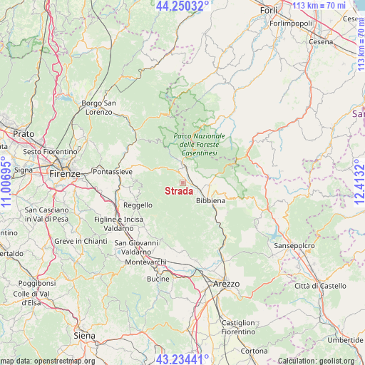
Strada GPS coordinates[2]
43° 44' 40.272" North, 11° 42' 36.252" East
| Map corner | latitude | longitude |
|---|---|---|
| Upper-left | 44.25032°, | 11.00695° |
| Center: | 43.74452°, | 11.71007° |
| Lower-right: | 43.23441°, | 12.4132° |
| Map W x H: | 113×113 km | = 70.2×70.2mi |
| max Lat: | 47.04031° ⇑57.6% North |
| Strada: | 43.74452° |
| min Lat: | ⇓42.4% South 35.50142° |
| min Long | Strada | max Long |
| 6.69888° | 11.71007° | 18.48682° |
| W 52%⇐ | ⇒48% E |
Elevation
Elevation of Strada is 376 m = 1234 ft, and this is 69.3 m = 227 ft above average elevation for this country.
| Max E: |
2085 m = 6841 ft | 31.7% |
| Strada | 376 m 1234 ft | |
| Avg. | 306.7 m = 1006 ft | |
Min E: |
-4 m = -13 ft | 68.3% |
See also: Italy elevation on elevation.city.
Geographical zone
Strada is located in North temperate zone (between Tropic of Cancer and the Arctic Circle). Distance of this Northern Tropic circle is 2258 km =1403.1 mi to South.| Distance of | km | miles | from Strada |
|---|---|---|---|
| North Pole | 5143.1 | 3195.8 | to North |
| Arctic Circle | 2537.2 | 1576.5 | to North |
| Tropic Cancer | 2258 | 1403.1 | to South |
| Equator | 4863.9 | 3022.3 | to South |


Nearby cities:
15 places around Strada: (largest is in red/bold)
• Badia Prataglia
14.6 km =9.1 mi,  67°
67°
• Bibbiena
9.8 km =6.1 mi,  121°
121°
• Castel San Niccolò
0.1 km =0.1 mi,  264°
264°
• La Pieve-Molino
7.3 km =4.5 mi, 263°
• Montemignaio
7.3 km =4.5 mi,  265°
265°
• Ortignano Raggiolo
7.8 km =4.8 mi,  156°
156°
• Partina
9 km =5.6 mi,  86°
86°
• Pietrapiana
15.4 km =9.6 mi,  249°
249°
• Ponte a Poppi
4.8 km =3 mi,  107°
107°
• Poppi
5.2 km =3.2 mi, 119°
• Pratovecchio
4.8 km =3 mi,  12°
12°
• Rassina
14.8 km =9.2 mi,  136°
136°
• Soci
8.3 km =5.2 mi,  102°
102°
• Stia
6 km =3.7 mi,  359°
359°
• Tosi
14.3 km =8.9 mi, 272°
Sources, notices
• [Note1] Compared only with cities in Italy existing in our database
• [Src1] Map data: © OpenStreetMap contributors (CC-BY-SA)
• [Src2] Other city data from geonames.org with taken over terms of usage.
• [Src3] Geographical zone / Annual Mean Temperature by Robert A. Rohde @ Wikipedia
