Ponte a Poppi geodata
Ponte a Poppi (Tuscany) is a populated place; located in Italy in Europe/Rome (GMT+2) time zone. With population of 2,570 people, there are 3442 cities with bigger population in this country. Compared to other cities in Italy, 57.8% of cities are located further ↑North; 52.7% of cities are located further ←West and 65.3% of cities have lower elevation than Ponte a Poppi. Note1


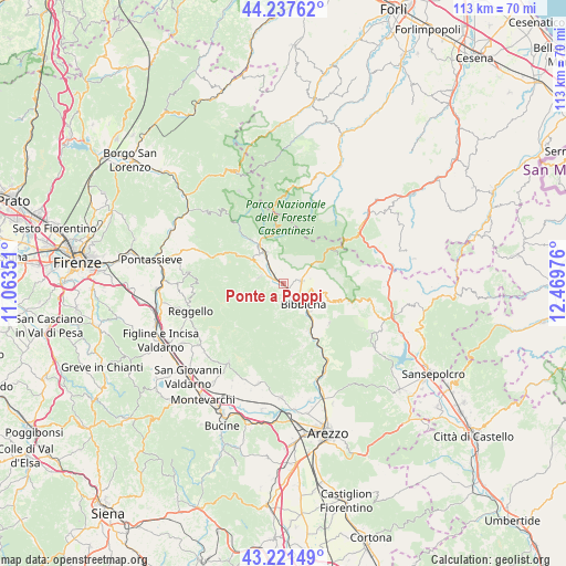
Ponte a Poppi GPS coordinates[2]
43° 43' 54.156" North, 11° 45' 59.868" East
| Map corner | latitude | longitude |
|---|---|---|
| Upper-left | 44.23762°, | 11.06351° |
| Center: | 43.73171°, | 11.76663° |
| Lower-right: | 43.22149°, | 12.46976° |
| Map W x H: | 113×113 km | = 70.2×70.2mi |
| max Lat: | 47.04031° ⇑57.8% North |
| Ponte a Poppi: | 43.73171° |
| min Lat: | ⇓42.2% South 35.50142° |
| min Long | Ponte a Poppi | max Long |
| 6.69888° | 11.76663° | 18.48682° |
| W 52.7%⇐ | ⇒47.3% E |
Elevation
Elevation of Ponte a Poppi is 346 m = 1135 ft, and this is 39.3 m = 129 ft above average elevation for this country.
| Max E: |
2085 m = 6841 ft | 34.7% |
| Ponte a Poppi | 346 m 1135 ft | |
| Avg. | 306.7 m = 1006 ft | |
Min E: |
-4 m = -13 ft | 65.3% |
See also: Italy elevation on elevation.city.
Geographical zone
Ponte a Poppi is located in North temperate zone (between Tropic of Cancer and the Arctic Circle). Distance of this Northern Tropic circle is 2256.6 km =1402.2 mi to South.| Distance of | km | miles | from Ponte a Poppi |
|---|---|---|---|
| North Pole | 5144.6 | 3196.7 | to North |
| Arctic Circle | 2538.7 | 1577.5 | to North |
| Tropic Cancer | 2256.6 | 1402.2 | to South |
| Equator | 4862.5 | 3021.4 | to South |


Nearby cities:
15 places around Ponte a Poppi: (largest is in red/bold)
• Badia Prataglia
11.4 km =7.1 mi,  52°
52°
• Bibbiena
5.3 km =3.3 mi,  133°
133°
• Castel San Niccolò
4.8 km =3 mi,  287°
287°
• Chitignano
12.1 km =7.5 mi, 130°
• Chiusi della Verna
14.1 km =8.8 mi,  105°
105°
• La Pieve-Molino
11.8 km =7.3 mi,  273°
273°
• Montemignaio
11.9 km =7.4 mi, 274°
• Ortignano Raggiolo
5.9 km =3.7 mi,  193°
193°
• Partina
4.8 km =3 mi,  66°
66°
• Poppi
1.2 km =0.7 mi,  180°
180°
• Pratovecchio
7 km =4.3 mi,  330°
330°
• Rassina
10.9 km =6.8 mi,  149°
149°
• Soci
3.6 km =2.2 mi,  96°
96°
• Stia
8.8 km =5.5 mi, 328°
• Strada
4.8 km =3 mi, 287°
Sources, notices
• [Note1] Compared only with cities in Italy existing in our database
• [Src1] Map data: © OpenStreetMap contributors (CC-BY-SA)
• [Src2] Other city data from geonames.org with taken over terms of usage.
• [Src3] Geographical zone / Annual Mean Temperature by Robert A. Rohde @ Wikipedia
