Cerrelli geodata
Cerrelli (Campania) is a populated place; located in Italy in Europe/Rome (GMT+2) time zone. With population of 966 people, there are 6789 cities with bigger population in this country. Compared to other cities in Italy, 84% of cities are located further ↑North; 88% of cities are located further ←West and 78.8% of cities have higher elevation than Cerrelli. Note1
Administrative division(s):
- Level 1: Campania
- Level 2: Provincia di Salerno
- Level 3: Altavilla Silentina


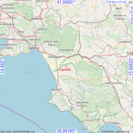
Cerrelli GPS coordinates[2]
40° 31' 42.636" North, 15° 6' 18.432" East
| Map corner | latitude | longitude |
|---|---|---|
| Upper-left | 41.06081°, | 14.402° |
| Center: | 40.52851°, | 15.10512° |
| Lower-right: | 39.99195°, | 15.80825° |
| Map W x H: | 118.8×118.8 km | = 73.8×73.8mi |
| max Lat: | 47.04031° ⇑84% North |
| Cerrelli: | 40.52851° |
| min Lat: | ⇓16% South 35.50142° |
| min Long | Cerrelli | max Long |
| 6.69888° | 15.10512° | 18.48682° |
| W 88%⇐ | ⇒12% E |
Elevation
Elevation of Cerrelli is 55 m = 180 ft, and this is 251.7 m = 826 ft below average elevation for this country.
| Max E: |
2085 m = 6841 ft | 78.8% |
| Avg. | 306.7 m = 1006 ft | |
| Cerrelli | 55 m = 180 ft | |
Min E: |
-4 m = -13 ft | 21.2% |
See also: Italy elevation on elevation.city.
Geographical zone
Cerrelli is located in North temperate zone (between Tropic of Cancer and the Arctic Circle). Distance of this Northern Tropic circle is 1900.4 km =1180.9 mi to South.| Distance of | km | miles | from Cerrelli |
|---|---|---|---|
| North Pole | 5500.7 | 3418 | to North |
| Arctic Circle | 2894.8 | 1798.7 | to North |
| Tropic Cancer | 1900.4 | 1180.9 | to South |
| Equator | 4506.3 | 2800.1 | to South |


Nearby cities:
15 places around Cerrelli: (largest is in red/bold)
• Albanella
5.5 km =3.4 mi,  171°
171°
• Altavilla Silentina
2.2 km =1.4 mi,  85°
85°
• Bivio Santa Cecilia
8.9 km =5.5 mi,  265°
265°
• Borgo Carillia
3.7 km =2.3 mi,  278°
278°
• Capaccio Scalo
11.5 km =7.1 mi,  224°
224°
• Castelcivita
11.5 km =7.1 mi,  109°
109°
• Controne
8.6 km =5.3 mi,  103°
103°
• Eboli
10.7 km =6.6 mi,  337°
337°
• Matinella
4.4 km =2.7 mi,  227°
227°
• Ponte Barizzo
8.4 km =5.2 mi,  242°
242°
• Postiglione
11.3 km =7 mi,  72°
72°
• Quadrivio
10.7 km =6.6 mi,  359°
359°
• Rettifilo-Vannullo
10.8 km =6.7 mi, 217°
• Santa Lucia-Santa Maria la Nova
11.5 km =7.1 mi,  349°
349°
• Serre
9.1 km =5.7 mi,  48°
48°
Sources, notices
• [Note1] Compared only with cities in Italy existing in our database
• [Src1] Map data: © OpenStreetMap contributors (CC-BY-SA)
• [Src2] Other city data from geonames.org with taken over terms of usage.
• [Src3] Geographical zone / Annual Mean Temperature by Robert A. Rohde @ Wikipedia
