Rettifilo-Vannullo geodata
Rettifilo-Vannullo (Campania) is a populated place; located in Italy in Europe/Rome (GMT+2) time zone. With population of 1,425 people, there are 5307 cities with bigger population in this country. Compared to other cities in Italy, 84.4% of cities are located further ↑North; 87.5% of cities are located further ←West and 85% of cities have higher elevation than Rettifilo-Vannullo. Note1
Administrative division(s):
- Level 1: Campania
- Level 2: Provincia di Salerno
- Level 3: Capaccio Paestum


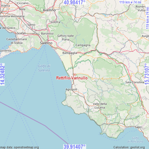
Rettifilo-Vannullo GPS coordinates[2]
40° 27' 4.5" North, 15° 1' 40.584" East
| Map corner | latitude | longitude |
|---|---|---|
| Upper-left | 40.98417°, | 14.32482° |
| Center: | 40.45125°, | 15.02794° |
| Lower-right: | 39.91407°, | 15.73107° |
| Map W x H: | 119×119 km | = 73.9×73.9mi |
| max Lat: | 47.04031° ⇑84.4% North |
| Rettifilo-Vannullo: | 40.45125° |
| min Lat: | ⇓15.6% South 35.50142° |
| min Long | Rettifilo-Vannu | max Long |
| 6.69888° | 15.02794° | 18.48682° |
| W 87.5%⇐ | ⇒12.5% E |
Elevation
Elevation of Rettifilo-Vannullo is 31 m = 102 ft, and this is 275.7 m = 905 ft below average elevation for this country.
| Max E: |
2085 m = 6841 ft | 85% |
| Avg. | 306.7 m = 1006 ft | |
| Rettifilo-Vannullo | 31 m = 102 ft | |
Min E: |
-4 m = -13 ft | 15% |
See also: Italy elevation on elevation.city.
Geographical zone
Rettifilo-Vannullo is located in North temperate zone (between Tropic of Cancer and the Arctic Circle). Distance of this Northern Tropic circle is 1891.8 km =1175.5 mi to South.| Distance of | km | miles | from Rettifilo-Vannullo |
|---|---|---|---|
| North Pole | 5509.3 | 3423.3 | to North |
| Arctic Circle | 2903.4 | 1804.1 | to North |
| Tropic Cancer | 1891.8 | 1175.5 | to South |
| Equator | 4497.8 | 2794.8 | to South |


Nearby cities:
15 places around Rettifilo-Vannullo: (largest is in red/bold)
• Albanella
8 km =5 mi,  66°
66°
• Bivio Santa Cecilia
8.2 km =5.1 mi,  343°
343°
• Borgo Carillia
9.6 km =6 mi,  17°
17°
• Cafasso-Borgo Nuovo
2 km =1.2 mi,  224°
224°
• Capaccio
5.3 km =3.3 mi,  124°
124°
• Capaccio Scalo
1.7 km =1.1 mi,  285°
285°
• Cerrelli
10.8 km =6.7 mi,  37°
37°
• Giungano
9.3 km =5.8 mi,  132°
132°
• Laura
3.9 km =2.4 mi,  237°
237°
• Licinella-Torre di Paestum
5.6 km =3.5 mi,  207°
207°
• Matinella
6.5 km =4 mi,  30°
30°
• Mattine
7.3 km =4.5 mi,  182°
182°
• Ponte Barizzo
4.7 km =2.9 mi,  349°
349°
• Santa Venere
4.7 km =2.9 mi,  196°
196°
• Trentinara
9.3 km =5.8 mi, 127°
Sources, notices
• [Note1] Compared only with cities in Italy existing in our database
• [Src1] Map data: © OpenStreetMap contributors (CC-BY-SA)
• [Src2] Other city data from geonames.org with taken over terms of usage.
• [Src3] Geographical zone / Annual Mean Temperature by Robert A. Rohde @ Wikipedia
