Mozzano geodata
Mozzano (The Marches) is a populated place; located in Italy in Europe/Rome (GMT+2) time zone. With population of 922 people, there are 7017 cities with bigger population in this country. Compared to other cities in Italy, 64.5% of cities are located further ↑North; 73.7% of cities are located further ←West and 55.2% of cities have higher elevation than Mozzano. Note1
Administrative division(s):
- Level 1: The Marches
- Level 2: Provincia di Ascoli Piceno
- Level 3: Ascoli Piceno


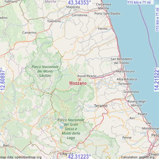
Mozzano GPS coordinates[2]
42° 49' 48.108" North, 13° 30' 43.524" East
| Map corner | latitude | longitude |
|---|---|---|
| Upper-left | 43.34353°, | 12.80897° |
| Center: | 42.83003°, | 13.51209° |
| Lower-right: | 42.31223°, | 14.21522° |
| Map W x H: | 114.7×114.7 km | = 71.3×71.3mi |
| max Lat: | 47.04031° ⇑64.5% North |
| Mozzano: | 42.83003° |
| min Lat: | ⇓35.5% South 35.50142° |
| min Long | Mozzano | max Long |
| 6.69888° | 13.51209° | 18.48682° |
| W 73.7%⇐ | ⇒26.3% E |
Elevation
Elevation of Mozzano is 201 m = 659 ft, and this is 105.7 m = 347 ft below average elevation for this country.
| Max E: |
2085 m = 6841 ft | 55.2% |
| Avg. | 306.7 m = 1006 ft | |
| Mozzano | 201 m = 659 ft | |
Min E: |
-4 m = -13 ft | 44.8% |
See also: Italy elevation on elevation.city.
Geographical zone
Mozzano is located in North temperate zone (between Tropic of Cancer and the Arctic Circle). Distance of this Northern Tropic circle is 2156.3 km =1339.9 mi to South.| Distance of | km | miles | from Mozzano |
|---|---|---|---|
| North Pole | 5244.8 | 3259 | to North |
| Arctic Circle | 2638.9 | 1639.7 | to North |
| Tropic Cancer | 2156.3 | 1339.9 | to South |
| Equator | 4762.3 | 2959.2 | to South |


Nearby cities:
15 places around Mozzano: (largest is in red/bold)
• Acquasanta Terme
10.3 km =6.4 mi,  230°
230°
• Ascoli Piceno
5.7 km =3.5 mi,  62°
62°
• Caselle
13.1 km =8.1 mi,  84°
84°
• Folignano
9.9 km =6.2 mi,  96°
96°
• Marsia
4.5 km =2.8 mi,  318°
318°
• Paggese-Santa Maria
9.6 km =6 mi, 232°
• Palmiano
8.8 km =5.5 mi,  330°
330°
• Piagge
5.3 km =3.3 mi, 80°
• Piane di Morro
11.5 km =7.1 mi,  93°
93°
• Ripaberarda
12.6 km =7.8 mi,  36°
36°
• Valle Castellana
10.5 km =6.5 mi,  186°
186°
• Venagrande
7.2 km =4.5 mi,  20°
20°
• Venarotta
6.1 km =3.8 mi,  344°
344°
• Villa Lempa
11.5 km =7.1 mi,  110°
110°
• Villa Pigna
10 km =6.2 mi, 87°
Sources, notices
• [Note1] Compared only with cities in Italy existing in our database
• [Src1] Map data: © OpenStreetMap contributors (CC-BY-SA)
• [Src2] Other city data from geonames.org with taken over terms of usage.
• [Src3] Geographical zone / Annual Mean Temperature by Robert A. Rohde @ Wikipedia
