Braglia geodata
Braglia (Veneto) is a seat of a third-order administrative division; located in Italy in Europe/Rome (GMT+2) time zone. With population of 902 people, there are 7138 cities with bigger population in this country. Compared to other cities in Italy, 59.6% of cities are located further ↓South; 56.3% of cities are located further ←West and 99.8% of cities have higher elevation than Braglia. Note1


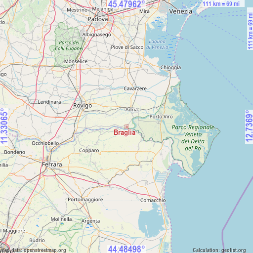
Braglia GPS coordinates[2]
44° 59' 4.056" North, 12° 2' 1.572" East
| Map corner | latitude | longitude |
|---|---|---|
| Upper-left | 45.47962°, | 11.33065° |
| Center: | 44.98446°, | 12.03377° |
| Lower-right: | 44.48498°, | 12.7369° |
| Map W x H: | 110.6×110.6 km | = 68.7×68.7mi |
| max Lat: | 47.04031° ⇑40.4% North |
| Braglia: | 44.98446° |
| min Lat: | ⇓59.6% South 35.50142° |
| min Long | Braglia | max Long |
| 6.69888° | 12.03377° | 18.48682° |
| W 56.3%⇐ | ⇒43.7% E |
Elevation
Elevation of Braglia is -1 m = -3 ft, and this is 307.7 m = 1010 ft below average elevation for this country.
| Max E: |
2085 m = 6841 ft | 99.8% |
| Avg. | 306.7 m = 1006 ft | |
| Braglia | -1 m = -3 ft | |
Min E: |
-4 m = -13 ft | 0.2% |
See also: Italy elevation on elevation.city.
Geographical zone
Braglia is located in North temperate zone (between Tropic of Cancer and the Arctic Circle). Distance of this Northern Tropic circle is 2395.9 km =1488.7 mi to South.| Distance of | km | miles | from Braglia |
|---|---|---|---|
| North Pole | 5005.3 | 3110.1 | to North |
| Arctic Circle | 2399.4 | 1490.9 | to North |
| Tropic Cancer | 2395.9 | 1488.7 | to South |
| Equator | 5001.8 | 3108 | to South |


Nearby cities:
15 places around Braglia: (largest is in red/bold)
• Adria
8 km =5 mi,  12°
12°
• Ariano
8.3 km =5.2 mi,  120°
120°
• Ariano Ferrarese
8 km =5 mi,  126°
126°
• Baricetta
8.6 km =5.3 mi,  340°
340°
• Berra
4.5 km =2.8 mi,  258°
258°
• Bottrighe
6 km =3.7 mi,  39°
39°
• Cologna
11 km =6.8 mi, 260°
• Corbola
4.6 km =2.9 mi,  63°
63°
• Gavello
10.4 km =6.5 mi,  295°
295°
• Mezzogoro
10.5 km =6.5 mi,  150°
150°
• Papozze
0.3 km =0.2 mi, 303°
• Papozze
10.5 km =6.5 mi,  90°
90°
• Serravalle
2.4 km =1.5 mi, 154°
• Valliera
8.6 km =5.3 mi,  350°
350°
• Villanova Marchesana
5.3 km =3.3 mi,  279°
279°
Sources, notices
• [Note1] Compared only with cities in Italy existing in our database
• [Src1] Map data: © OpenStreetMap contributors (CC-BY-SA)
• [Src2] Other city data from geonames.org with taken over terms of usage.
• [Src3] Geographical zone / Annual Mean Temperature by Robert A. Rohde @ Wikipedia
