Massina geodata
Massina (Lombardy) is a populated place; located in Italy in Europe/Rome (GMT+2) time zone. With population of 890 people, there are 7207 cities with bigger population in this country. Compared to other cities in Italy, 78.8% of cities are located further ↓South; 81.6% of cities are located further →East and 50.6% of cities have higher elevation than Massina. Note1


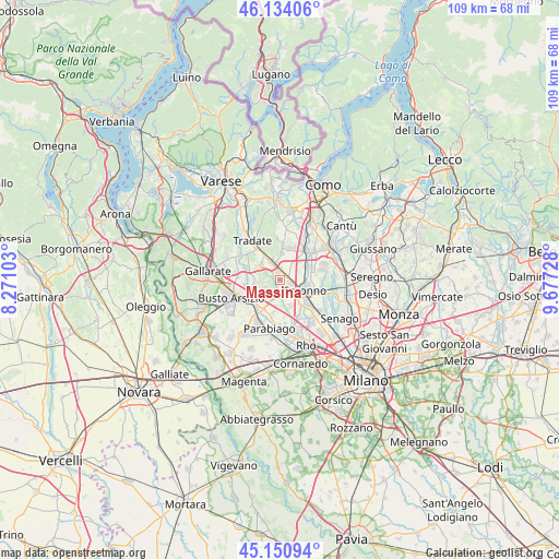
Massina GPS coordinates[2]
45° 38' 40.776" North, 8° 58' 26.94" East
| Map corner | latitude | longitude |
|---|---|---|
| Upper-left | 46.13406°, | 8.27103° |
| Center: | 45.64466°, | 8.97415° |
| Lower-right: | 45.15094°, | 9.67728° |
| Map W x H: | 109.3×109.3 km | = 67.9×67.9mi |
| max Lat: | 47.04031° ⇑21.2% North |
| Massina: | 45.64466° |
| min Lat: | ⇓78.8% South 35.50142° |
| min Long | Massina | max Long |
| 6.69888° | 8.97415° | 18.48682° |
| W 18.4%⇐ | ⇒81.6% E |
Elevation
Elevation of Massina is 231 m = 758 ft, and this is 75.7 m = 248 ft below average elevation for this country.
| Max E: |
2085 m = 6841 ft | 50.6% |
| Avg. | 306.7 m = 1006 ft | |
| Massina | 231 m = 758 ft | |
Min E: |
-4 m = -13 ft | 49.4% |
See also: Italy elevation on elevation.city.
Geographical zone
Massina is located in North temperate zone (between Tropic of Cancer and the Arctic Circle). Distance of this North polar circle is 2326 km =1445.3 mi to North.| Distance of | km | miles | from Massina |
|---|---|---|---|
| North Pole | 4931.9 | 3064.5 | to North |
| Arctic Circle | 2326 | 1445.3 | to North |
| Tropic Cancer | 2469.3 | 1534.4 | to South |
| Equator | 5075.2 | 3153.6 | to South |


Nearby cities:
15 places around Massina: (largest is in red/bold)
• Carbonate
5.3 km =3.3 mi,  328°
328°
• Cascina Restelli
4.2 km =2.6 mi,  16°
16°
• Cerro Maggiore
5.9 km =3.7 mi,  195°
195°
• Cislago
1.6 km =1 mi,  356°
356°
• Gerenzano
2.2 km =1.4 mi,  104°
104°
• Gorla Minore
5.6 km =3.5 mi,  266°
266°
• Limido Comasco
5 km =3.1 mi,  5°
5°
• Manera
6.1 km =3.8 mi,  58°
58°
• Marnate
5.4 km =3.4 mi,  250°
250°
• Mozzate
3.6 km =2.2 mi,  337°
337°
• Rescaldina
3.4 km =2.1 mi,  215°
215°
• Rovello Porro
5.1 km =3.2 mi,  80°
80°
• Saronno
5.2 km =3.2 mi,  114°
114°
• Turate
2.7 km =1.7 mi, 59°
• Uboldo
4 km =2.5 mi,  144°
144°
Sources, notices
• [Note1] Compared only with cities in Italy existing in our database
• [Src1] Map data: © OpenStreetMap contributors (CC-BY-SA)
• [Src2] Other city data from geonames.org with taken over terms of usage.
• [Src3] Geographical zone / Annual Mean Temperature by Robert A. Rohde @ Wikipedia
