Sant'Amato-Nasuti geodata
Sant'Amato-Nasuti (Abruzzo) is a populated place; located in Italy in Europe/Rome (GMT+2) time zone. With population of 824 people, there are 7530 cities with bigger population in this country. Compared to other cities in Italy, 68.4% of cities are located further ↑North; 81.3% of cities are located further ←West and 57.6% of cities have lower elevation than Sant'Amato-Nasuti. Note1


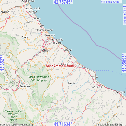
Sant'Amato-Nasuti GPS coordinates[2]
42° 14' 20.544" North, 14° 21' 20.952" East
| Map corner | latitude | longitude |
|---|---|---|
| Upper-left | 42.75745°, | 13.6527° |
| Center: | 42.23904°, | 14.35582° |
| Lower-right: | 41.71634°, | 15.05895° |
| Map W x H: | 115.8×115.8 km | = 72×72mi |
| max Lat: | 47.04031° ⇑68.4% North |
| Sant'Amato-Nasuti: | 42.23904° |
| min Lat: | ⇓31.6% South 35.50142° |
| min Long | Sant'Amato-Nasu | max Long |
| 6.69888° | 14.35582° | 18.48682° |
| W 81.3%⇐ | ⇒18.7% E |
Elevation
Elevation of Sant'Amato-Nasuti is 283 m = 928 ft, and this is 23.7 m = 78 ft below average elevation for this country.
| Max E: |
2085 m = 6841 ft | 42.4% |
| Avg. | 306.7 m = 1006 ft | |
| Sant'Amato-Nasuti | 283 m = 928 ft | |
Min E: |
-4 m = -13 ft | 57.6% |
See also: Italy elevation on elevation.city.
Geographical zone
Sant'Amato-Nasuti is located in North temperate zone (between Tropic of Cancer and the Arctic Circle). Distance of this Northern Tropic circle is 2090.6 km =1299 mi to South.| Distance of | km | miles | from Sant'Amato-Nasuti |
|---|---|---|---|
| North Pole | 5310.5 | 3299.8 | to North |
| Arctic Circle | 2704.6 | 1680.6 | to North |
| Tropic Cancer | 2090.6 | 1299 | to South |
| Equator | 4696.5 | 2918.3 | to South |


Nearby cities:
15 places around Sant'Amato-Nasuti: (largest is in red/bold)
• Arielli
4.4 km =2.7 mi,  301°
301°
• Canosa Sannita
7.6 km =4.7 mi,  326°
326°
• Castel Frentano
4.5 km =2.8 mi,  179°
179°
• Crecchio
7 km =4.3 mi,  339°
339°
• Frisa
3.4 km =2.1 mi,  29°
29°
• Lanciano
3.1 km =1.9 mi,  114°
114°
• Mozzagrogna
7.7 km =4.8 mi, 112°
• Orsogna
6.4 km =4 mi,  254°
254°
• Poggiofiorito
3.3 km =2.1 mi, 300°
• Rocca San Giovanni
8.7 km =5.4 mi,  84°
84°
• Sant'Apollinare
7.8 km =4.8 mi, 34°
• Sant'Eusanio del Sangro
8.1 km =5 mi,  196°
196°
• Santa Maria Imbaro
8.1 km =5 mi, 105°
• Treglio
6.1 km =3.8 mi,  65°
65°
• Villa Caldari
6.3 km =3.9 mi,  4°
4°
Sources, notices
• [Note1] Compared only with cities in Italy existing in our database
• [Src1] Map data: © OpenStreetMap contributors (CC-BY-SA)
• [Src2] Other city data from geonames.org with taken over terms of usage.
• [Src3] Geographical zone / Annual Mean Temperature by Robert A. Rohde @ Wikipedia
