Sant'Apollinare geodata
Sant'Apollinare (Abruzzo) is a populated place; located in Italy in Europe/Rome (GMT+2) time zone. With population of 765 people, there are 7846 cities with bigger population in this country. Compared to other cities in Italy, 67.8% of cities are located further ↑North; 81.9% of cities are located further ←West and 61.8% of cities have higher elevation than Sant'Apollinare. Note1
Administrative division(s):
- Level 1: Abruzzo
- Level 2: Provincia di Chieti
- Level 3: San Vito Chietino


Sant'Apollinare GPS coordinates[2]
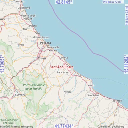
42° 17' 47.652" North, 14° 24' 34.884" East
| Map corner | latitude | longitude |
|---|---|---|
| Upper-left | 42.8145°, | 13.70657° |
| Center: | 42.29657°, | 14.40969° |
| Lower-right: | 41.77434°, | 15.11282° |
| Map W x H: | 115.7×115.7 km | = 71.9×71.9mi |
| max Lat: | 47.04031° ⇑67.8% North |
| Sant'Apollinare: | 42.29657° |
| min Lat: | ⇓32.2% South 35.50142° |
| min Long | Sant'Apollinare | max Long |
| 6.69888° | 14.40969° | 18.48682° |
| W 81.9%⇐ | ⇒18.1% E |
Elevation
Elevation of Sant'Apollinare is 150 m = 492 ft, and this is 156.7 m = 514 ft below average elevation for this country.
| Max E: |
2085 m = 6841 ft | 61.8% |
| Avg. | 306.7 m = 1006 ft | |
| Sant'Apollinare | 150 m = 492 ft | |
Min E: |
-4 m = -13 ft | 38.2% |
See also: Italy elevation on elevation.city.
Geographical zone
Sant'Apollinare is located in North temperate zone (between Tropic of Cancer and the Arctic Circle). Distance of this Northern Tropic circle is 2097 km =1303 mi to South.| Distance of | km | miles | from Sant'Apollinare |
|---|---|---|---|
| North Pole | 5304.1 | 3295.8 | to North |
| Arctic Circle | 2698.2 | 1676.6 | to North |
| Tropic Cancer | 2097 | 1303 | to South |
| Equator | 4702.9 | 2922.2 | to South |


Nearby cities:
15 places around Sant'Apollinare: (largest is in red/bold)
• Canosa Sannita
8.6 km =5.3 mi,  269°
269°
• Crecchio
6.8 km =4.2 mi, 271°
• Fossacesia
8.6 km =5.3 mi,  135°
135°
• Frisa
4.4 km =2.7 mi,  218°
218°
• Lanciano
7.9 km =4.9 mi,  191°
191°
• Marina di San Vito
3.3 km =2.1 mi,  73°
73°
• Ortona
6.1 km =3.8 mi,  355°
355°
• Rocca San Giovanni
7.1 km =4.4 mi, 142°
• San Vito Chietino
2.8 km =1.7 mi,  104°
104°
• Sant'Amato-Nasuti
7.8 km =4.8 mi,  214°
214°
• Santa Lucia
4 km =2.5 mi,  353°
353°
• Treglio
4 km =2.5 mi,  163°
163°
• Villa Caldari
4 km =2.5 mi, 268°
• Villa Grande
5.2 km =3.2 mi,  313°
313°
• Villa San Leonardo
1.8 km =1.1 mi,  333°
333°
Sources, notices
• [Note1] Compared only with cities in Italy existing in our database
• [Src1] Map data: © OpenStreetMap contributors (CC-BY-SA)
• [Src2] Other city data from geonames.org with taken over terms of usage.
• [Src3] Geographical zone / Annual Mean Temperature by Robert A. Rohde @ Wikipedia
