Rodeghieri-Rigoni-Podestà-Costa geodata
Rodeghieri-Rigoni-Podestà-Costa (Veneto) is a populated place; located in Italy in Europe/Rome (GMT+2) time zone. With population of 797 people, there are 7666 cities with bigger population in this country. Compared to other cities in Italy, 88.9% of cities are located further ↓South; 50.4% of cities are located further →East and 97.5% of cities have lower elevation than Rodeghieri-Rigoni-Podestà-Costa. Note1
Current local time in Rodeghieri-Rigoni-Podestà-Costa:
11:14 PM, WednesdayDifference from your time zone: hours


Rodeghieri-Rigoni-Podestà-Costa GPS coordinates[2]
45° 53' 23.46" North, 11° 30' 53.532" East
| Map corner | latitude | longitude |
|---|---|---|
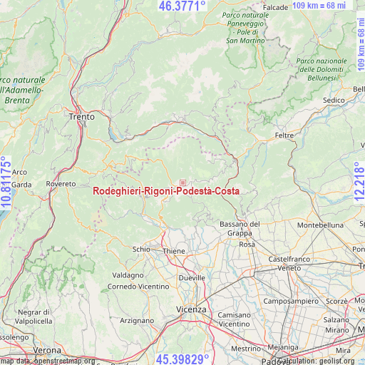
| Upper-left | 46.3771°, | 10.81175° |
| Center: | 45.88985°, | 11.51487° |
| Lower-right: | 45.39829°, | 12.218° |
| Map W x H: | 108.8×108.8 km | = 67.6×67.6mi |
| max Lat: | 47.04031° ⇑11.1% North |
| Rodeghieri-Rigoni-Podestà-Costa: | 45.88985° |
| min Lat: | ⇓88.9% South 35.50142° |
| min Long | Rodeghieri-Rigo | max Long |
| 6.69888° | 11.51487° | 18.48682° |
| W 49.6%⇐ | ⇒50.4% E |
Elevation
Elevation of Rodeghieri-Rigoni-Podestà-Costa is 1048 m = 3438 ft, and this is 741.3 m = 2432 ft above average elevation for this country.
| Max E: |
2085 m = 6841 ft | 2.5% |
| Rodeghieri-Rigoni-Podestà-Costa | 1048 m 3438 ft | |
| Avg. | 306.7 m = 1006 ft | |
Min E: |
-4 m = -13 ft | 97.5% |
See also: Italy elevation on elevation.city.
Geographical zone
Rodeghieri-Rigoni-Podestà-Costa is located in North temperate zone (between Tropic of Cancer and the Arctic Circle). Distance of this North polar circle is 2298.7 km =1428.3 mi to North.| Distance of | km | miles | from Rodeghieri-Rigoni-Podestà-Costa |
|---|---|---|---|
| North Pole | 4904.6 | 3047.6 | to North |
| Arctic Circle | 2298.7 | 1428.3 | to North |
| Tropic Cancer | 2496.6 | 1551.3 | to South |
| Equator | 5102.5 | 3170.5 | to South |


Nearby cities:
15 places around Rodeghieri-Rigoni-Podestà-Costa: (largest is in red/bold)
• Asiago
1.6 km =1 mi,  187°
187°
• Caltrano
13.7 km =8.5 mi,  199°
199°
• Canove di Roana
4.3 km =2.7 mi,  227°
227°
• Cesuna
7.4 km =4.6 mi,  218°
218°
• Conco
12.4 km =7.7 mi,  143°
143°
• Foza
9 km =5.6 mi,  84°
84°
• Gallio
1.6 km =1 mi,  109°
109°
• Lusiana
12.6 km =7.8 mi,  158°
158°
• Roana
5 km =3.1 mi,  253°
253°
• Rotzo
9.7 km =6 mi, 251°
• San Pietro Valdastico
11.9 km =7.4 mi,  268°
268°
• Tonezza del Cimone
13.5 km =8.4 mi,  255°
255°
• Treschè Conca
8.8 km =5.5 mi, 229°
• Valstagna
12.5 km =7.8 mi, 110°
• Velo
13.5 km =8.4 mi, 163°
Sources, notices
• [Note1] Compared only with cities in Italy existing in our database
• [Src1] Map data: © OpenStreetMap contributors (CC-BY-SA)
• [Src2] Other city data from geonames.org with taken over terms of usage.
• [Src3] Geographical zone / Annual Mean Temperature by Robert A. Rohde @ Wikipedia
