Vedrana geodata
Vedrana (Emilia-Romagna) is a populated place; located in Italy in Europe/Rome (GMT+2) time zone. With population of 658 people, there are 8573 cities with bigger population in this country. Compared to other cities in Italy, 51.8% of cities are located further ↓South; 50.4% of cities are located further ←West and 90.6% of cities have higher elevation than Vedrana. Note1


Vedrana GPS coordinates[2]
44° 33' 23.508" North, 11° 34' 23.16" East
| Map corner | latitude | longitude |
|---|---|---|
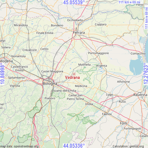
| Upper-left | 45.05539°, | 10.86998° |
| Center: | 44.55653°, | 11.5731° |
| Lower-right: | 44.05336°, | 12.27623° |
| Map W x H: | 111.4×111.4 km | = 69.2×69.2mi |
| max Lat: | 47.04031° ⇑48.2% North |
| Vedrana: | 44.55653° |
| min Lat: | ⇓51.8% South 35.50142° |
| min Long | Vedrana | max Long |
| 6.69888° | 11.5731° | 18.48682° |
| W 50.4%⇐ | ⇒49.6% E |
Elevation
Elevation of Vedrana is 17 m = 56 ft, and this is 289.7 m = 950 ft below average elevation for this country.
| Max E: |
2085 m = 6841 ft | 90.6% |
| Avg. | 306.7 m = 1006 ft | |
| Vedrana | 17 m = 56 ft | |
Min E: |
-4 m = -13 ft | 9.4% |
See also: Italy elevation on elevation.city.
Geographical zone
Vedrana is located in North temperate zone (between Tropic of Cancer and the Arctic Circle). Distance of this Northern Tropic circle is 2348.3 km =1459.2 mi to South.| Distance of | km | miles | from Vedrana |
|---|---|---|---|
| North Pole | 5052.8 | 3139.7 | to North |
| Arctic Circle | 2447 | 1520.5 | to North |
| Tropic Cancer | 2348.3 | 1459.2 | to South |
| Equator | 4954.2 | 3078.4 | to South |


Nearby cities:
15 places around Vedrana: (largest is in red/bold)
• Baricella
10.6 km =6.6 mi,  344°
344°
• Budrio
3.7 km =2.3 mi,  235°
235°
• Castenaso
9.6 km =6 mi, 240°
• Cà Dè Fabbri
11.7 km =7.3 mi,  306°
306°
• Ganzanigo
10.8 km =6.7 mi,  142°
142°
• Granarolo dell'Emilia e Viadagola
10.3 km =6.4 mi,  267°
267°
• Medicina-Buda
10.1 km =6.3 mi,  149°
149°
• Mezzolara
3.7 km =2.3 mi,  349°
349°
• Minerbio
10.5 km =6.5 mi, 310°
• Molinella
10.1 km =6.3 mi,  47°
47°
• Ponte Rizzoli
11.4 km =7.1 mi,  205°
205°
• San Martino in Argine
4.5 km =2.8 mi,  36°
36°
• San Pietro Capofiume
12 km =7.5 mi,  29°
29°
• Sant'Antonio
11.4 km =7.1 mi,  84°
84°
• Villa Fontana
7.5 km =4.7 mi,  157°
157°
Sources, notices
• [Note1] Compared only with cities in Italy existing in our database
• [Src1] Map data: © OpenStreetMap contributors (CC-BY-SA)
• [Src2] Other city data from geonames.org with taken over terms of usage.
• [Src3] Geographical zone / Annual Mean Temperature by Robert A. Rohde @ Wikipedia
