Campodenno geodata
Campodenno (Trentino-Alto Adige) is a seat of a third-order administrative division; located in Italy in Europe/Rome (GMT+2) time zone. With population of 430 people, there are 10163 cities with bigger population in this country. Compared to other cities in Italy, 96.5% of cities are located further ↓South; 56.8% of cities are located further →East and 81.5% of cities have lower elevation than Campodenno. Note1
Administrative division(s):
- Level 1: Trentino-Alto Adige
- Level 2: Provincia autonoma di Trento
- Level 3: Campodenno


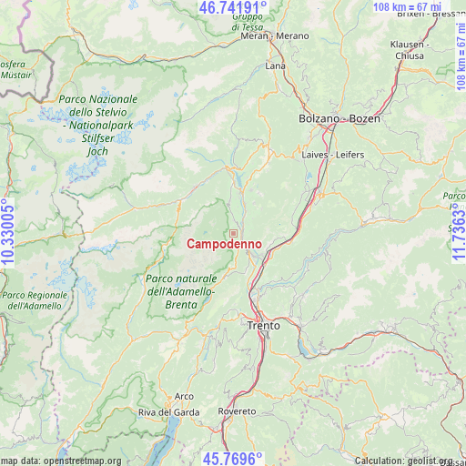
Campodenno GPS coordinates[2]
46° 15' 28.476" North, 11° 1' 59.412" East
| Map corner | latitude | longitude |
|---|---|---|
| Upper-left | 46.74191°, | 10.33005° |
| Center: | 46.25791°, | 11.03317° |
| Lower-right: | 45.7696°, | 11.7363° |
| Map W x H: | 108.1×108.1 km | = 67.2×67.2mi |
| max Lat: | 47.04031° ⇑3.5% North |
| Campodenno: | 46.25791° |
| min Lat: | ⇓96.5% South 35.50142° |
| min Long | Campodenno | max Long |
| 6.69888° | 11.03317° | 18.48682° |
| W 43.2%⇐ | ⇒56.8% E |
Elevation
Elevation of Campodenno is 546 m = 1791 ft, and this is 239.3 m = 785 ft above average elevation for this country.
| Max E: |
2085 m = 6841 ft | 18.5% |
| Campodenno | 546 m 1791 ft | |
| Avg. | 306.7 m = 1006 ft | |
Min E: |
-4 m = -13 ft | 81.5% |
See also: Italy elevation on elevation.city.
Geographical zone
Campodenno is located in North temperate zone (between Tropic of Cancer and the Arctic Circle). Distance of this North polar circle is 2257.8 km =1402.9 mi to North.| Distance of | km | miles | from Campodenno |
|---|---|---|---|
| North Pole | 4863.7 | 3022.2 | to North |
| Arctic Circle | 2257.8 | 1402.9 | to North |
| Tropic Cancer | 2537.5 | 1576.7 | to South |
| Equator | 5143.4 | 3196 | to South |


Nearby cities:
15 places around Campodenno: (largest is in red/bold)
• Cavedago
8.1 km =5 mi,  180°
180°
• Cunevo
3.2 km =2 mi,  1°
1°
• Denno
2.2 km =1.4 mi,  34°
34°
• Flavon
4.5 km =2.8 mi,  356°
356°
• Mezzocorona
8.6 km =5.3 mi,  126°
126°
• Mezzolombardo
7.4 km =4.6 mi,  138°
138°
• Nanno
6.4 km =4 mi,  9°
9°
• Segno
6.2 km =3.9 mi, 30°
• Spormaggiore
4.5 km =2.8 mi,  165°
165°
• Sporminore
2.4 km =1.5 mi,  187°
187°
• Taio
7.5 km =4.7 mi,  19°
19°
• Terres
5.8 km =3.6 mi,  352°
352°
• Tres
8.6 km =5.3 mi, 34°
• Tuenno
7.9 km =4.9 mi, 354°
• Vigo di Ton
4.3 km =2.7 mi,  78°
78°
Sources, notices
• [Note1] Compared only with cities in Italy existing in our database
• [Src1] Map data: © OpenStreetMap contributors (CC-BY-SA)
• [Src2] Other city data from geonames.org with taken over terms of usage.
• [Src3] Geographical zone / Annual Mean Temperature by Robert A. Rohde @ Wikipedia
