Sammā ar Rawsān geodata
Sammā ar Rawsān (Irbid) is a seat of a second-order administrative division; located in Jordan in Asia/Amman (GMT+3) time zone. In our database, there are 84 cities with bigger population. Compared to other cities in Jordan, 93.5% of cities are located further ↓South; 55.8% of cities are located further ←West and 76.1% of cities have higher elevation than Sammā ar Rawsān. Note1


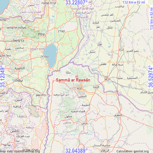
Sammā ar Rawsān GPS coordinates[2]
32° 38' 16.584" North, 35° 49' 35.796" East
| Map corner | latitude | longitude |
|---|---|---|
| Upper-left | 33.22807°, | 35.12349° |
| Center: | 32.63794°, | 35.82661° |
| Lower-right: | 32.04389°, | 36.52974° |
| Map W x H: | 131.7×131.7 km | = 81.8×81.8mi |
| max Lat: | 33.31405° ⇑6.5% North |
| Sammā ar Rawsān: | 32.63794° |
| min Lat: | ⇓93.5% South 29.40842° |
| min Long | Sammā ar Raws� | max Long |
| 34.97918° | 35.82661° | 38.70342° |
| W 55.8%⇐ | ⇒44.2% E |
Elevation
Elevation of Sammā ar Rawsān is 556 m = 1824 ft, and this is 129.7 m = 426 ft below average elevation for this country.
| Max E: |
1440 m = 4724 ft | 76.1% |
| Avg. | 685.7 m = 2250 ft | |
| Sammā ar Rawsān | 556 m = 1824 ft | |
Min E: |
-366 m = -1201 ft | 23.9% |
See also: Jordan elevation on elevation.city.
Geographical zone
Sammā ar Rawsān is located in North temperate zone (between Tropic of Cancer and the Arctic Circle). Distance of this Northern Tropic circle is 1023.1 km =635.7 mi to South.| Distance of | km | miles | from Sammā ar Rawsān |
|---|---|---|---|
| North Pole | 6378.1 | 3963.2 | to North |
| Arctic Circle | 3772.2 | 2343.9 | to North |
| Tropic Cancer | 1023.1 | 635.7 | to South |
| Equator | 3629 | 2255 | to South |


Nearby cities:
15 places around Sammā ar Rawsān: (largest is in red/bold)
• Ash Shajarah
10.8 km =6.7 mi,  86°
86°
• Aţ Ţayyibah
14.7 km =9.1 mi,  224°
224°
• Bayt Yāfā
13.4 km =8.3 mi,  196°
196°
• Irbid
9.4 km =5.8 mi,  166°
166°
• Kafr Asad
11.6 km =7.2 mi,  247°
247°
• Kafr Sawm
5.8 km =3.6 mi,  335°
335°
• Kharjā
6.2 km =3.9 mi,  66°
66°
• Malkā
8.5 km =5.3 mi,  300°
300°
• Qumaym
11.3 km =7 mi,  229°
229°
• Saḩam al Kaffārāt
8.3 km =5.2 mi,  324°
324°
• Sāl
11.1 km =6.9 mi,  133°
133°
• Umm Qays
13.4 km =8.3 mi,  277°
277°
• Zaḩar
9.1 km =5.7 mi,  209°
209°
• Ḩakamā
7.2 km =4.5 mi, 132°
• Ḩātim
4.6 km =2.9 mi, 279°
Sources, notices
• [Note1] Compared only with cities in Jordan existing in our database
• [Src1] Map data: © OpenStreetMap contributors (CC-BY-SA)
• [Src2] Other city data from geonames.org with taken over terms of usage.
• [Src3] Geographical zone / Annual Mean Temperature by Robert A. Rohde @ Wikipedia
