Kharjā geodata
Kharjā (Irbid) is a populated place; located in Jordan in Asia/Amman (GMT+3) time zone. With population of 5,498 people, there are 59 cities with bigger population in this country. Compared to other cities in Jordan, 97.1% of cities are located further ↓South; 65.9% of cities are located further ←West and 81.9% of cities have higher elevation than Kharjā. Note1


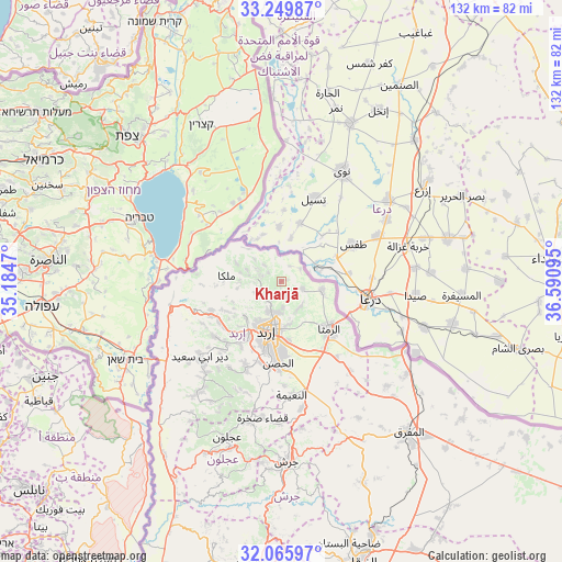
Kharjā GPS coordinates[2]
32° 39' 35.568" North, 35° 53' 16.152" East
| Map corner | latitude | longitude |
|---|---|---|
| Upper-left | 33.24987°, | 35.1847° |
| Center: | 32.65988°, | 35.88782° |
| Lower-right: | 32.06597°, | 36.59095° |
| Map W x H: | 131.6×131.6 km | = 81.8×81.8mi |
| max Lat: | 33.31405° ⇑2.9% North |
| Kharjā: | 32.65988° |
| min Lat: | ⇓97.1% South 29.40842° |
| min Long | Kharjā | max Long |
| 34.97918° | 35.88782° | 38.70342° |
| W 65.9%⇐ | ⇒34.1% E |
Elevation
Elevation of Kharjā is 449 m = 1473 ft, and this is 236.7 m = 777 ft below average elevation for this country.
| Max E: |
1440 m = 4724 ft | 81.9% |
| Avg. | 685.7 m = 2250 ft | |
| Kharjā | 449 m = 1473 ft | |
Min E: |
-366 m = -1201 ft | 18.1% |
See also: Jordan elevation on elevation.city.
Geographical zone
Kharjā is located in North temperate zone (between Tropic of Cancer and the Arctic Circle). Distance of this Northern Tropic circle is 1025.5 km =637.2 mi to South.| Distance of | km | miles | from Kharjā |
|---|---|---|---|
| North Pole | 6375.6 | 3961.6 | to North |
| Arctic Circle | 3769.7 | 2342.4 | to North |
| Tropic Cancer | 1025.5 | 637.2 | to South |
| Equator | 3631.4 | 2256.4 | to South |


Nearby cities:
15 places around Kharjā: (largest is in red/bold)
• Ar Ramthā
15.9 km =9.9 mi,  134°
134°
• Ash Shajarah
5.4 km =3.4 mi,  109°
109°
• Aydūn
17.4 km =10.8 mi,  189°
189°
• Aţ Ţurrah
9.8 km =6.1 mi,  103°
103°
• Irbid
12.1 km =7.5 mi,  196°
196°
• Kafr Asad
17.8 km =11.1 mi,  247°
247°
• Kafr Sawm
8.6 km =5.3 mi,  289°
289°
• Malkā
13.2 km =8.2 mi,  278°
278°
• Qumaym
17.4 km =10.8 mi,  235°
235°
• Sammā ar Rawsān
6.2 km =3.9 mi, 246°
• Saḩam al Kaffārāt
11.5 km =7.1 mi, 292°
• Sāl
10.4 km =6.5 mi,  167°
167°
• Zaḩar
14.6 km =9.1 mi,  224°
224°
• Ḩakamā
7.4 km =4.6 mi,  183°
183°
• Ḩātim
10.4 km =6.5 mi,  260°
260°
Sources, notices
• [Note1] Compared only with cities in Jordan existing in our database
• [Src1] Map data: © OpenStreetMap contributors (CC-BY-SA)
• [Src2] Other city data from geonames.org with taken over terms of usage.
• [Src3] Geographical zone / Annual Mean Temperature by Robert A. Rohde @ Wikipedia
