Sāl geodata
Sāl (Irbid) is a populated place; located in Jordan in Asia/Amman (GMT+3) time zone. With population of 6,896 people, there are 48 cities with bigger population in this country. Compared to other cities in Jordan, 89.1% of cities are located further ↓South; 69.6% of cities are located further ←West and 72.5% of cities have higher elevation than Sāl. Note1


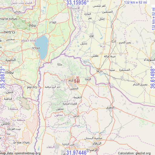
Sāl GPS coordinates[2]
32° 34' 8.292" North, 35° 54' 42.66" East
| Map corner | latitude | longitude |
|---|---|---|
| Upper-left | 33.15956°, | 35.20873° |
| Center: | 32.56897°, | 35.91185° |
| Lower-right: | 31.97446°, | 36.61498° |
| Map W x H: | 131.8×131.8 km | = 81.9×81.9mi |
| max Lat: | 33.31405° ⇑10.9% North |
| Sāl: | 32.56897° |
| min Lat: | ⇓89.1% South 29.40842° |
| min Long | Sāl | max Long |
| 34.97918° | 35.91185° | 38.70342° |
| W 69.6%⇐ | ⇒30.4% E |
Elevation
Elevation of Sāl is 571 m = 1873 ft, and this is 114.7 m = 376 ft below average elevation for this country.
| Max E: |
1440 m = 4724 ft | 72.5% |
| Avg. | 685.7 m = 2250 ft | |
| Sāl | 571 m = 1873 ft | |
Min E: |
-366 m = -1201 ft | 27.5% |
See also: Jordan elevation on elevation.city.
Geographical zone
Sāl is located in North temperate zone (between Tropic of Cancer and the Arctic Circle). Distance of this Northern Tropic circle is 1015.4 km =630.9 mi to South.| Distance of | km | miles | from Sāl |
|---|---|---|---|
| North Pole | 6385.7 | 3967.9 | to North |
| Arctic Circle | 3779.8 | 2348.7 | to North |
| Tropic Cancer | 1015.4 | 630.9 | to South |
| Equator | 3621.3 | 2250.2 | to South |


Nearby cities:
15 places around Sāl: (largest is in red/bold)
• Al Mazār ash Shamālī
15.4 km =9.6 mi,  224°
224°
• Al Ḩişn
9.7 km =6 mi,  195°
195°
• Ar Ramthā
9.1 km =5.7 mi,  97°
97°
• Ash Shajarah
8.8 km =5.5 mi,  18°
18°
• Aydūn
8.7 km =5.4 mi, 215°
• Aţ Ţurrah
10.7 km =6.6 mi,  42°
42°
• Bayt Yāfā
12.9 km =8 mi,  246°
246°
• Dayr Yūsuf
14.2 km =8.8 mi,  229°
229°
• Irbid
6 km =3.7 mi,  255°
255°
• Kharjā
10.4 km =6.5 mi,  347°
347°
• Kitim
14.6 km =9.1 mi,  185°
185°
• Sammā ar Rawsān
11.1 km =6.9 mi,  313°
313°
• Zaḩar
12.5 km =7.8 mi,  268°
268°
• Ḩakamā
3.8 km =2.4 mi,  315°
315°
• Ḩātim
15.1 km =9.4 mi,  303°
303°
Sources, notices
• [Note1] Compared only with cities in Jordan existing in our database
• [Src1] Map data: © OpenStreetMap contributors (CC-BY-SA)
• [Src2] Other city data from geonames.org with taken over terms of usage.
• [Src3] Geographical zone / Annual Mean Temperature by Robert A. Rohde @ Wikipedia
