Zaḩar geodata
Zaḩar (Irbid) is a populated place; located in Jordan in Asia/Amman (GMT+3) time zone. With population of 4,150 people, there are 77 cities with bigger population in this country. Compared to other cities in Jordan, 88.4% of cities are located further ↓South; 55.8% of cities are located further →East and 83.3% of cities have higher elevation than Zaḩar. Note1


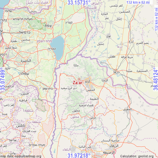
Zaḩar GPS coordinates[2]
32° 34' 0.12" North, 35° 46' 41.196" East
| Map corner | latitude | longitude |
|---|---|---|
| Upper-left | 33.15731°, | 35.07499° |
| Center: | 32.5667°, | 35.77811° |
| Lower-right: | 31.97218°, | 36.48124° |
| Map W x H: | 131.8×131.8 km | = 81.9×81.9mi |
| max Lat: | 33.31405° ⇑11.6% North |
| Zaḩar: | 32.5667° |
| min Lat: | ⇓88.4% South 29.40842° |
| min Long | Zaḩar | max Long |
| 34.97918° | 35.77811° | 38.70342° |
| W 44.2%⇐ | ⇒55.8% E |
Elevation
Elevation of Zaḩar is 437 m = 1434 ft, and this is 248.7 m = 816 ft below average elevation for this country.
| Max E: |
1440 m = 4724 ft | 83.3% |
| Avg. | 685.7 m = 2250 ft | |
| Zaḩar | 437 m = 1434 ft | |
Min E: |
-366 m = -1201 ft | 16.7% |
See also: Jordan elevation on elevation.city.
Geographical zone
Zaḩar is located in North temperate zone (between Tropic of Cancer and the Arctic Circle). Distance of this Northern Tropic circle is 1015.2 km =630.8 mi to South.| Distance of | km | miles | from Zaḩar |
|---|---|---|---|
| North Pole | 6386 | 3968.1 | to North |
| Arctic Circle | 3780.1 | 2348.8 | to North |
| Tropic Cancer | 1015.2 | 630.8 | to South |
| Equator | 3621.1 | 2250 | to South |


Nearby cities:
15 places around Zaḩar: (largest is in red/bold)
• Al Mazār ash Shamālī
10.9 km =6.8 mi,  170°
170°
• Aydūn
10.1 km =6.3 mi,  132°
132°
• Aţ Ţayyibah
6.3 km =3.9 mi,  245°
245°
• Bayt Yāfā
5 km =3.1 mi, 171°
• Dayr Abū Sa‘īd
11.5 km =7.1 mi,  228°
228°
• Dayr Yūsuf
9 km =5.6 mi, 169°
• Irbid
6.8 km =4.2 mi,  100°
100°
• Kafr Asad
7.1 km =4.4 mi,  299°
299°
• Qumaym
4.1 km =2.5 mi,  277°
277°
• Sammā ar Rawsān
9.1 km =5.7 mi,  29°
29°
• Sāl
12.5 km =7.8 mi,  88°
88°
• Tibnah
11.1 km =6.9 mi,  203°
203°
• Şammā
8.3 km =5.2 mi,  273°
273°
• Ḩakamā
10.3 km =6.4 mi,  73°
73°
• Ḩātim
8.7 km =5.4 mi,  359°
359°
Sources, notices
• [Note1] Compared only with cities in Jordan existing in our database
• [Src1] Map data: © OpenStreetMap contributors (CC-BY-SA)
• [Src2] Other city data from geonames.org with taken over terms of usage.
• [Src3] Geographical zone / Annual Mean Temperature by Robert A. Rohde @ Wikipedia
