Al Murayghah geodata
Al Murayghah (Ma’an) is a seat of a third-order administrative division; located in Jordan in Asia/Amman (GMT+3) time zone. In our database, there are 84 cities with bigger population. Compared to other cities in Jordan, 97.1% of cities are located further ↑North; 93.5% of cities are located further →East and 98.6% of cities have lower elevation than Al Murayghah. Note1


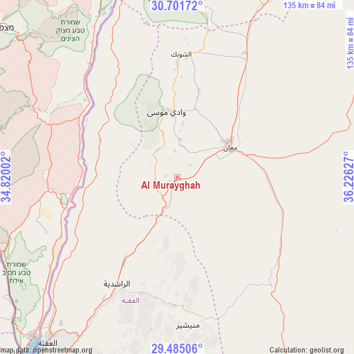
Al Murayghah GPS coordinates[2]
30° 5' 42.936" North, 35° 31' 23.304" East
| Map corner | latitude | longitude |
|---|---|---|
| Upper-left | 30.70172°, | 34.82002° |
| Center: | 30.09526°, | 35.52314° |
| Lower-right: | 29.48506°, | 36.22627° |
| Map W x H: | 135.3×135.3 km | = 84.1×84.1mi |
| max Lat: | 33.31405° ⇑97.1% North |
| Al Murayghah: | 30.09526° |
| min Lat: | ⇓2.9% South 29.40842° |
| min Long | Al Murayghah | max Long |
| 34.97918° | 35.52314° | 38.70342° |
| W 6.5%⇐ | ⇒93.5% E |
Elevation
Elevation of Al Murayghah is 1387 m = 4551 ft, and this is 701.3 m = 2301 ft above average elevation for this country.
| Max E: |
1440 m = 4724 ft | 1.4% |
| Al Murayghah | 1387 m 4551 ft | |
| Avg. | 685.7 m = 2250 ft | |
Min E: |
-366 m = -1201 ft | 98.6% |
See also: Jordan elevation on elevation.city.
Geographical zone
Al Murayghah is located in North temperate zone (between Tropic of Cancer and the Arctic Circle). Distance of this Northern Tropic circle is 740.4 km =460.1 mi to South.| Distance of | km | miles | from Al Murayghah |
|---|---|---|---|
| North Pole | 6660.8 | 4138.8 | to North |
| Arctic Circle | 4054.9 | 2519.6 | to North |
| Tropic Cancer | 740.4 | 460.1 | to South |
| Equator | 3346.3 | 2079.3 | to South |


Nearby cities:
15 places around Al Murayghah: (largest is in red/bold)
• Ad Dīsah
49.2 km =30.6 mi,  181°
181°
• Adhruḩ
27.1 km =16.8 mi,  15°
15°
• Al Jafr
67.6 km =42 mi,  68°
68°
• Al Quwayrah
38.6 km =24 mi,  211°
211°
• Al Ḩasā
91.6 km =56.9 mi,  28°
28°
• Al Ḩusaynīyah
61.5 km =38.2 mi, 25°
• Aqaba
80.4 km =50 mi,  218°
218°
• Ar Rīshah
32.8 km =20.4 mi,  295°
295°
• Ash Shawbak
47.6 km =29.6 mi,  5°
5°
• Ayl
12.4 km =7.7 mi, 5°
• Aţ Ţafīlah
82.9 km =51.5 mi, 5°
• Aţ Ţayyibah
18.2 km =11.3 mi,  342°
342°
• Buşayrā
71.3 km =44.3 mi, 6°
• Ma'an
23.2 km =14.4 mi,  61°
61°
• Petra
25.5 km =15.8 mi,  350°
350°
Sources, notices
• [Note1] Compared only with cities in Jordan existing in our database
• [Src1] Map data: © OpenStreetMap contributors (CC-BY-SA)
• [Src2] Other city data from geonames.org with taken over terms of usage.
• [Src3] Geographical zone / Annual Mean Temperature by Robert A. Rohde @ Wikipedia
