Aţ Ţayyibah geodata
Aţ Ţayyibah (Ma’an) is a populated place; located in Jordan in Asia/Amman (GMT+3) time zone. With population of 4,265 people, there are 74 cities with bigger population in this country. Compared to other cities in Jordan, 94.2% of cities are located further ↑North; 96.4% of cities are located further →East and 99.3% of cities have lower elevation than Aţ Ţayyibah. Note1


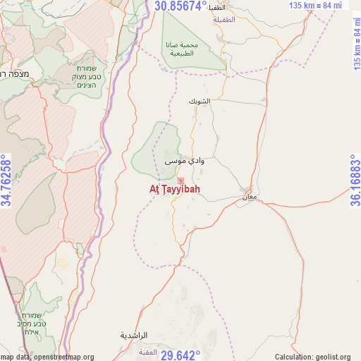
Aţ Ţayyibah GPS coordinates[2]
30° 15' 4.5" North, 35° 27' 56.52" East
| Map corner | latitude | longitude |
|---|---|---|
| Upper-left | 30.85674°, | 34.76258° |
| Center: | 30.25125°, | 35.4657° |
| Lower-right: | 29.642°, | 36.16883° |
| Map W x H: | 135.1×135.1 km | = 83.9×83.9mi |
| max Lat: | 33.31405° ⇑94.2% North |
| Aţ Ţayyibah: | 30.25125° |
| min Lat: | ⇓5.8% South 29.40842° |
| min Long | Aţ Ţayyibah | max Long |
| 34.97918° | 35.4657° | 38.70342° |
| W 3.6%⇐ | ⇒96.4% E |
Elevation
Elevation of Aţ Ţayyibah is 1420 m = 4659 ft, and this is 734.3 m = 2409 ft above average elevation for this country.
| Max E: |
1440 m = 4724 ft | 0.7% |
| Aţ Ţayyibah | 1420 m 4659 ft | |
| Avg. | 685.7 m = 2250 ft | |
Min E: |
-366 m = -1201 ft | 99.3% |
See also: Jordan elevation on elevation.city.
Geographical zone
Aţ Ţayyibah is located in North temperate zone (between Tropic of Cancer and the Arctic Circle). Distance of this Northern Tropic circle is 757.7 km =470.8 mi to South.| Distance of | km | miles | from Aţ Ţayyibah |
|---|---|---|---|
| North Pole | 6643.4 | 4128 | to North |
| Arctic Circle | 4037.6 | 2508.8 | to North |
| Tropic Cancer | 757.7 | 470.8 | to South |
| Equator | 3363.6 | 2090 | to South |


Nearby cities:
15 places around Aţ Ţayyibah: (largest is in red/bold)
• Ad Dīsah
66.7 km =41.4 mi,  176°
176°
• Adhruḩ
15.4 km =9.6 mi,  54°
54°
• Al Jafr
68.8 km =42.8 mi,  83°
83°
• Al Murayghah
18.2 km =11.3 mi,  162°
162°
• Al Quwayrah
52.3 km =32.5 mi,  196°
196°
• Al Ḩasā
80 km =49.7 mi,  37°
37°
• Al Ḩusaynīyah
49.7 km =30.9 mi, 39°
• Ar Rīshah
24.1 km =15 mi,  262°
262°
• Ash Shawbak
31.7 km =19.7 mi,  18°
18°
• Ayl
8.5 km =5.3 mi,  126°
126°
• Aţ Ţafīlah
66.5 km =41.3 mi,  11°
11°
• Buşayrā
55.3 km =34.4 mi, 14°
• Ma'an
26.5 km =16.5 mi,  103°
103°
• Petra
7.9 km =4.9 mi, 9°
• Safi
87.3 km =54.2 mi,  359°
359°
Sources, notices
• [Note1] Compared only with cities in Jordan existing in our database
• [Src1] Map data: © OpenStreetMap contributors (CC-BY-SA)
• [Src2] Other city data from geonames.org with taken over terms of usage.
• [Src3] Geographical zone / Annual Mean Temperature by Robert A. Rohde @ Wikipedia
