Ash Shawbak geodata
Ash Shawbak (Ma’an) is a seat of a second-order administrative division; located in Jordan in Asia/Amman (GMT+3) time zone. With population of 50 people, there are 83 cities with bigger population in this country. Compared to other cities in Jordan, 91.3% of cities are located further ↑North; 92% of cities are located further →East and 97.8% of cities have lower elevation than Ash Shawbak. Note1


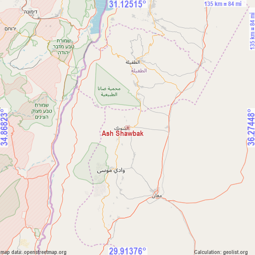
Ash Shawbak GPS coordinates[2]
30° 31' 16.824" North, 35° 34' 16.86" East
| Map corner | latitude | longitude |
|---|---|---|
| Upper-left | 31.12515°, | 34.86823° |
| Center: | 30.52134°, | 35.57135° |
| Lower-right: | 29.91376°, | 36.27448° |
| Map W x H: | 134.7×134.7 km | = 83.7×83.7mi |
| max Lat: | 33.31405° ⇑91.3% North |
| Ash Shawbak: | 30.52134° |
| min Lat: | ⇓8.7% South 29.40842° |
| min Long | Ash Shawbak | max Long |
| 34.97918° | 35.57135° | 38.70342° |
| W 8%⇐ | ⇒92% E |
Elevation
Elevation of Ash Shawbak is 1331 m = 4367 ft, and this is 645.3 m = 2117 ft above average elevation for this country.
| Max E: |
1440 m = 4724 ft | 2.2% |
| Ash Shawbak | 1331 m 4367 ft | |
| Avg. | 685.7 m = 2250 ft | |
Min E: |
-366 m = -1201 ft | 97.8% |
See also: Jordan elevation on elevation.city.
Geographical zone
Ash Shawbak is located in North temperate zone (between Tropic of Cancer and the Arctic Circle). Distance of this Northern Tropic circle is 787.7 km =489.5 mi to South.| Distance of | km | miles | from Ash Shawbak |
|---|---|---|---|
| North Pole | 6613.4 | 4109.4 | to North |
| Arctic Circle | 4007.5 | 2490.1 | to North |
| Tropic Cancer | 787.7 | 489.5 | to South |
| Equator | 3393.7 | 2108.7 | to South |


Nearby cities:
15 places around Ash Shawbak: (largest is in red/bold)
• Adhruḩ
21.3 km =13.2 mi,  173°
173°
• Al Khinzīrah
58.9 km =36.6 mi,  3°
3°
• Al Mazār al Janūbī
61.8 km =38.4 mi,  10°
10°
• Al Murayghah
47.6 km =29.6 mi,  185°
185°
• Al Ḩasā
51 km =31.7 mi,  49°
49°
• Al Ḩusaynīyah
23.1 km =14.4 mi,  69°
69°
• Al Ḩusaynīyah
58 km =36 mi, 14°
• Ar Rīshah
47.4 km =29.5 mi,  225°
225°
• Ayl
35.2 km =21.9 mi, 185°
• Aţ Ţafīlah
35.3 km =21.9 mi, 5°
• Aţ Ţayyibah
31.7 km =19.7 mi,  198°
198°
• Buşayrā
23.8 km =14.8 mi, 8°
• Ma'an
39.4 km =24.5 mi,  156°
156°
• Petra
24 km =14.9 mi, 201°
• Safi
58.1 km =36.1 mi,  349°
349°
Sources, notices
• [Note1] Compared only with cities in Jordan existing in our database
• [Src1] Map data: © OpenStreetMap contributors (CC-BY-SA)
• [Src2] Other city data from geonames.org with taken over terms of usage.
• [Src3] Geographical zone / Annual Mean Temperature by Robert A. Rohde @ Wikipedia
