Jāwā geodata
Jāwā (Amman) is a populated place; located in Jordan in Asia/Amman (GMT+3) time zone. With population of 10,628 people, there are 34 cities with bigger population in this country. Compared to other cities in Jordan, 66.7% of cities are located further ↑North; 73.2% of cities are located further ←West and 73.9% of cities have lower elevation than Jāwā. Note1


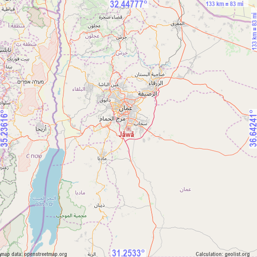
Jāwā GPS coordinates[2]
31° 51' 8.892" North, 35° 56' 21.408" East
| Map corner | latitude | longitude |
|---|---|---|
| Upper-left | 32.44777°, | 35.23616° |
| Center: | 31.85247°, | 35.93928° |
| Lower-right: | 31.2533°, | 36.64241° |
| Map W x H: | 132.8×132.8 km | = 82.5×82.5mi |
| max Lat: | 33.31405° ⇑66.7% North |
| Jāwā: | 31.85247° |
| min Lat: | ⇓33.3% South 29.40842° |
| min Long | Jāwā | max Long |
| 34.97918° | 35.93928° | 38.70342° |
| W 73.2%⇐ | ⇒26.8% E |
Elevation
Elevation of Jāwā is 889 m = 2917 ft, and this is 203.3 m = 667 ft above average elevation for this country.
| Max E: |
1440 m = 4724 ft | 26.1% |
| Jāwā | 889 m 2917 ft | |
| Avg. | 685.7 m = 2250 ft | |
Min E: |
-366 m = -1201 ft | 73.9% |
See also: Jordan elevation on elevation.city.
Geographical zone
Jāwā is located in North temperate zone (between Tropic of Cancer and the Arctic Circle). Distance of this Northern Tropic circle is 935.7 km =581.4 mi to South.| Distance of | km | miles | from Jāwā |
|---|---|---|---|
| North Pole | 6465.4 | 4017.4 | to North |
| Arctic Circle | 3859.5 | 2398.2 | to North |
| Tropic Cancer | 935.7 | 581.4 | to South |
| Equator | 3541.7 | 2200.7 | to South |


Nearby cities:
15 places around Jāwā: (largest is in red/bold)
• Al Juwayyidah
3.9 km =2.4 mi,  349°
349°
• Al Jīzah
17.1 km =10.6 mi,  174°
174°
• Al Muwaqqar
16.6 km =10.3 mi,  104°
104°
• Al ‘Abdallī
12.9 km =8 mi, 346°
• Amman
11.4 km =7.1 mi,  2°
2°
• Juraynah
17.1 km =10.6 mi,  233°
233°
• Nā‘ūr
11.1 km =6.9 mi,  282°
282°
• Rujm ash Shāmī al Gharbī
6.4 km =4 mi,  105°
105°
• Saḩāb
6.5 km =4 mi,  72°
72°
• Umm al Basātīn
6.6 km =4.1 mi,  241°
241°
• Umm as Summāq
8.8 km =5.5 mi,  294°
294°
• Wādī as Sīr
16.1 km =10 mi,  314°
314°
• Ḩayy al Bunayyāt
7.1 km =4.4 mi, 313°
• Ḩayy al Quwaysimah
6.5 km =4 mi,  8°
8°
• Ḩisbān
13.6 km =8.5 mi, 243°
Sources, notices
• [Note1] Compared only with cities in Jordan existing in our database
• [Src1] Map data: © OpenStreetMap contributors (CC-BY-SA)
• [Src2] Other city data from geonames.org with taken over terms of usage.
• [Src3] Geographical zone / Annual Mean Temperature by Robert A. Rohde @ Wikipedia
