Ḩayy al Bunayyāt geodata
Ḩayy al Bunayyāt (Amman) is a section of populated place; located in Jordan in Asia/Amman (GMT+3) time zone. With population of 5,579 people, there are 57 cities with bigger population in this country. Compared to other cities in Jordan, 61.6% of cities are located further ↑North; 65.2% of cities are located further ←West and 80.4% of cities have lower elevation than Ḩayy al Bunayyāt. Note1


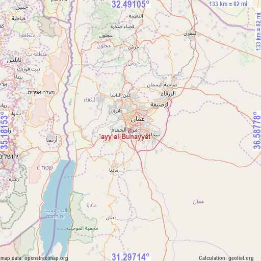
Ḩayy al Bunayyāt GPS coordinates[2]
31° 53' 45.708" North, 35° 53' 4.74" East
| Map corner | latitude | longitude |
|---|---|---|
| Upper-left | 32.49105°, | 35.18153° |
| Center: | 31.89603°, | 35.88465° |
| Lower-right: | 31.29714°, | 36.58778° |
| Map W x H: | 132.8×132.8 km | = 82.5×82.5mi |
| max Lat: | 33.31405° ⇑61.6% North |
| Ḩayy al Bunayyāt: | 31.89603° |
| min Lat: | ⇓38.4% South 29.40842° |
| min Long | Ḩayy al Bunay | max Long |
| 34.97918° | 35.88465° | 38.70342° |
| W 65.2%⇐ | ⇒34.8% E |
Elevation
Elevation of Ḩayy al Bunayyāt is 925 m = 3035 ft, and this is 239.3 m = 785 ft above average elevation for this country.
| Max E: |
1440 m = 4724 ft | 19.6% |
| Ḩayy al Bunayyāt | 925 m 3035 ft | |
| Avg. | 685.7 m = 2250 ft | |
Min E: |
-366 m = -1201 ft | 80.4% |
See also: Jordan elevation on elevation.city.
Geographical zone
Ḩayy al Bunayyāt is located in North temperate zone (between Tropic of Cancer and the Arctic Circle). Distance of this Northern Tropic circle is 940.6 km =584.5 mi to South.| Distance of | km | miles | from Ḩayy al Bunayyāt |
|---|---|---|---|
| North Pole | 6460.6 | 4014.4 | to North |
| Arctic Circle | 3854.7 | 2395.2 | to North |
| Tropic Cancer | 940.6 | 584.5 | to South |
| Equator | 3546.5 | 2203.7 | to South |


Nearby cities:
15 places around Ḩayy al Bunayyāt: (largest is in red/bold)
• Al Fuḩayş
15.5 km =9.6 mi,  320°
320°
• Al Jubayhah
12.8 km =8 mi,  5°
5°
• Al Juwayyidah
4.5 km =2.8 mi,  102°
102°
• Al ‘Abdallī
8 km =5 mi,  16°
16°
• Amman
8.7 km =5.4 mi,  40°
40°
• Juraynah
17.4 km =10.8 mi,  209°
209°
• Jāwā
7.1 km =4.4 mi,  133°
133°
• Nā‘ūr
6.2 km =3.9 mi,  246°
246°
• Rujm ash Shāmī al Gharbī
13.1 km =8.1 mi,  120°
120°
• Saḩāb
11.7 km =7.3 mi, 104°
• Umm al Basātīn
8 km =5 mi,  184°
184°
• Umm as Summāq
3.1 km =1.9 mi, 247°
• Wādī as Sīr
9 km =5.6 mi, 316°
• Ḩayy al Quwaysimah
6.3 km =3.9 mi,  75°
75°
• Ḩisbān
13 km =8.1 mi, 212°
Sources, notices
• [Note1] Compared only with cities in Jordan existing in our database
• [Src1] Map data: © OpenStreetMap contributors (CC-BY-SA)
• [Src2] Other city data from geonames.org with taken over terms of usage.
• [Src3] Geographical zone / Annual Mean Temperature by Robert A. Rohde @ Wikipedia
