Ar Ruwayshid geodata
Ar Ruwayshid (Mafraq) is a seat of a second-order administrative division; located in Jordan in Asia/Amman (GMT+3) time zone. In our database, there are 84 cities with bigger population. Compared to other cities in Jordan, 83.3% of cities are located further ↓South; 99.3% of cities are located further ←West and 55.1% of cities have higher elevation than Ar Ruwayshid. Note1


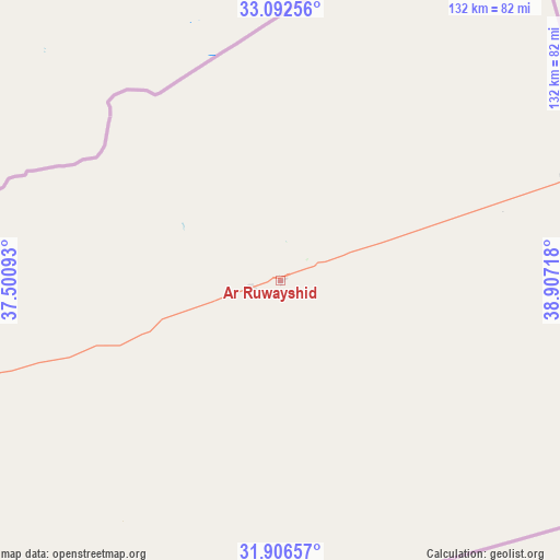
Ar Ruwayshid GPS coordinates[2]
32° 30' 5.472" North, 38° 12' 14.58" East
| Map corner | latitude | longitude |
|---|---|---|
| Upper-left | 33.09256°, | 37.50093° |
| Center: | 32.50152°, | 38.20405° |
| Lower-right: | 31.90657°, | 38.90718° |
| Map W x H: | 131.9×131.9 km | = 82×82mi |
| max Lat: | 33.31405° ⇑16.7% North |
| Ar Ruwayshid: | 32.50152° |
| min Lat: | ⇓83.3% South 29.40842° |
| min Long | Ar Ruwayshid | max Long |
| 34.97918° | 38.20405° | 38.70342° |
| W 99.3%⇐ | ⇒0.7% E |
Elevation
Elevation of Ar Ruwayshid is 694 m = 2277 ft, and this is 8.3 m = 27 ft above average elevation for this country.
| Max E: |
1440 m = 4724 ft | 55.1% |
| Ar Ruwayshid | 694 m 2277 ft | |
| Avg. | 685.7 m = 2250 ft | |
Min E: |
-366 m = -1201 ft | 44.9% |
See also: Jordan elevation on elevation.city.
Geographical zone
Ar Ruwayshid is located in North temperate zone (between Tropic of Cancer and the Arctic Circle). Distance of this Northern Tropic circle is 1007.9 km =626.3 mi to South.| Distance of | km | miles | from Ar Ruwayshid |
|---|---|---|---|
| North Pole | 6393.2 | 3972.5 | to North |
| Arctic Circle | 3787.3 | 2353.3 | to North |
| Tropic Cancer | 1007.9 | 626.3 | to South |
| Equator | 3613.8 | 2245.5 | to South |


Nearby cities:
15 places around Ar Ruwayshid: (largest is in red/bold)
• Al Azraq ash Shamālī
146.5 km =91 mi,  241°
241°
• Al Khālidīyah
182.1 km =113.2 mi,  258°
258°
• Al Ḩamrā’
192.6 km =119.7 mi,  267°
267°
• Az̧ Z̧ulayl
185.7 km =115.4 mi, 256°
• Dayr al Kahf
130.6 km =81.2 mi, 258°
• Mafraq
188.2 km =116.9 mi, 264°
• Muthallath Jāmi‘at Āl al Bayt
185.8 km =115.5 mi, 264°
• Muthallath al Azraq
150.4 km =93.5 mi, 240°
• Muthallath Şabḩā
165.2 km =102.7 mi, 260°
• Qaşr al Ḩallābāt
181.6 km =112.8 mi, 255°
• Rukban
101.7 km =63.2 mi,  27°
27°
• Samā as Sirḩān
183.9 km =114.3 mi, 268°
• Umm al Jimāl
173.4 km =107.7 mi, 263°
• Umm al Qiţţayn
149.4 km =92.8 mi, 261°
• Şabḩā
161 km =100 mi, 263°
Sources, notices
• [Note1] Compared only with cities in Jordan existing in our database
• [Src1] Map data: © OpenStreetMap contributors (CC-BY-SA)
• [Src2] Other city data from geonames.org with taken over terms of usage.
• [Src3] Geographical zone / Annual Mean Temperature by Robert A. Rohde @ Wikipedia
