Rukban geodata
Rukban (Mafraq) is a populated place; located in Jordan in Asia/Amman (GMT+3) time zone. With population of 85,000 people, there are 7 cities with bigger population in this country. Compared to other cities in Jordan, 100% of cities are located further ↓South; 100% of cities are located further ←West and 55.8% of cities have lower elevation than Rukban. Note1


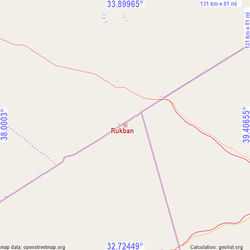
Rukban GPS coordinates[2]
33° 18' 50.58" North, 38° 42' 12.312" East
| Map corner | latitude | longitude |
|---|---|---|
| Upper-left | 33.89965°, | 38.0003° |
| Center: | 33.31405°, | 38.70342° |
| Lower-right: | 32.72449°, | 39.40655° |
| Map W x H: | 130.7×130.7 km | = 81.2×81.2mi |
| max Lat: | 33.31405° ⇑0% North |
| Rukban: | 33.31405° |
| min Lat: | ⇓100% South 29.40842° |
| min Long | Rukban | max Long |
| 34.97918° | 38.70342° | 38.70342° |
| W 100%⇐ | ⇒0% E |
Elevation
Elevation of Rukban is 772 m = 2533 ft, and this is 86.3 m = 283 ft above average elevation for this country.
| Max E: |
1440 m = 4724 ft | 44.2% |
| Rukban | 772 m 2533 ft | |
| Avg. | 685.7 m = 2250 ft | |
Min E: |
-366 m = -1201 ft | 55.8% |
See also: Rukban elevation on elevation.city.
Geographical zone
Rukban is located in North temperate zone (between Tropic of Cancer and the Arctic Circle). Distance of this Northern Tropic circle is 1098.3 km =682.5 mi to South.| Distance of | km | miles | from Rukban |
|---|---|---|---|
| North Pole | 6302.9 | 3916.4 | to North |
| Arctic Circle | 3697 | 2297.2 | to North |
| Tropic Cancer | 1098.3 | 682.5 | to South |
| Equator | 3704.2 | 2301.7 | to South |


Nearby cities:
15 places around Rukban: (largest is in red/bold)
• Al Azraq ash Shamālī
236.9 km =147.2 mi,  227°
227°
• Al Khālidīyah
257.5 km =160 mi,  240°
240°
• Al Ḩamrā’
257.2 km =159.8 mi,  247°
247°
• Ar Ruwayshid
101.7 km =63.2 mi,  207°
207°
• Dayr al Kahf
209 km =129.9 mi, 236°
• Mafraq
256.9 km =159.6 mi, 245°
• Muthallath Jāmi‘at Āl al Bayt
254.6 km =158.2 mi, 244°
• Muthallath al Azraq
241.7 km =150.2 mi, 227°
• Muthallath Şabḩā
239.6 km =148.9 mi, 240°
• Qaşr al Ḩallābāt
259.9 km =161.5 mi, 238°
• Samā as Sirḩān
248.1 km =154.2 mi, 247°
• Umm al Jimāl
244.2 km =151.7 mi, 243°
• Umm al Qiţţayn
223.5 km =138.9 mi, 240°
• Şabḩā
233.2 km =144.9 mi, 241°
• Ḩawshā
261.4 km =162.4 mi, 248°
Sources, notices
• [Note1] Compared only with cities in Jordan existing in our database
• [Src1] Map data: © OpenStreetMap contributors (CC-BY-SA)
• [Src2] Other city data from geonames.org with taken over terms of usage.
• [Src3] Geographical zone / Annual Mean Temperature by Robert A. Rohde @ Wikipedia
