Mafraq geodata
Mafraq is a seat of a first-order administrative division; located in Jordan in Asia/Amman (GMT+3) time zone. With population of 57,118 people, there are 11 cities with bigger population in this country. Compared to other cities in Jordan, 68.1% of cities are located further ↓South; 89.9% of cities are located further ←West and 52.2% of cities have higher elevation than Mafraq. Note1


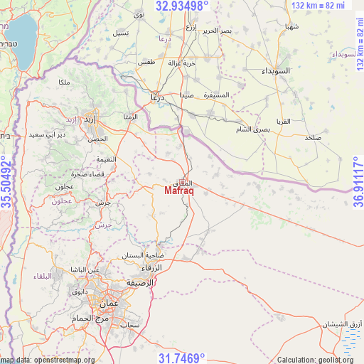
Mafraq GPS coordinates[2]
32° 20' 34.404" North, 36° 12' 28.944" East
| Map corner | latitude | longitude |
|---|---|---|
| Upper-left | 32.93498°, | 35.50492° |
| Center: | 32.34289°, | 36.20804° |
| Lower-right: | 31.7469°, | 36.91117° |
| Map W x H: | 132.1×132.1 km | = 82.1×82.1mi |
| max Lat: | 33.31405° ⇑31.9% North |
| Mafraq: | 32.34289° |
| min Lat: | ⇓68.1% South 29.40842° |
| min Long | Mafraq | max Long |
| 34.97918° | 36.20804° | 38.70342° |
| W 89.9%⇐ | ⇒10.1% E |
Elevation
Elevation of Mafraq is 705 m = 2313 ft, and this is 19.3 m = 63 ft above average elevation for this country.
| Max E: |
1440 m = 4724 ft | 52.2% |
| Mafraq | 705 m 2313 ft | |
| Avg. | 685.7 m = 2250 ft | |
Min E: |
-366 m = -1201 ft | 47.8% |
See also: Mafraq elevation on elevation.city.
Geographical zone
Mafraq is located in North temperate zone (between Tropic of Cancer and the Arctic Circle). Distance of this Northern Tropic circle is 990.3 km =615.3 mi to South.| Distance of | km | miles | from Mafraq |
|---|---|---|---|
| North Pole | 6410.9 | 3983.5 | to North |
| Arctic Circle | 3805 | 2364.3 | to North |
| Tropic Cancer | 990.3 | 615.3 | to South |
| Equator | 3596.2 | 2234.6 | to South |


Nearby cities:
15 places around Mafraq: (largest is in red/bold)
• Al Hāshimīyah
25.1 km =15.6 mi,  198°
198°
• Al Khālidīyah
20.3 km =12.6 mi,  153°
153°
• Al Ḩamrā’
12 km =7.5 mi,  334°
334°
• Az̧ Z̧ulayl
25.6 km =15.9 mi,  164°
164°
• Balīlā
25.9 km =16.1 mi,  281°
281°
• Bal‘amā
16.3 km =10.1 mi,  223°
223°
• Manshīyat Banī Ḩasan
12.5 km =7.8 mi, 284°
• Muthallath Jāmi‘at Āl al Bayt
2.4 km =1.5 mi,  81°
81°
• Muthallath Şabḩā
26.1 km =16.2 mi,  110°
110°
• Qafqafā
25.3 km =15.7 mi,  271°
271°
• Rehab
11.2 km =7 mi,  258°
258°
• Samā as Sirḩān
14.4 km =8.9 mi,  13°
13°
• Umm al Jimāl
15.1 km =9.4 mi,  96°
96°
• Şabḩā
27.6 km =17.1 mi,  93°
93°
• Ḩawshā
15.8 km =9.8 mi,  319°
319°
Sources, notices
• [Note1] Compared only with cities in Jordan existing in our database
• [Src1] Map data: © OpenStreetMap contributors (CC-BY-SA)
• [Src2] Other city data from geonames.org with taken over terms of usage.
• [Src3] Geographical zone / Annual Mean Temperature by Robert A. Rohde @ Wikipedia
