Toki geodata
Toki (Gifu) is a seat of a second-order administrative division; located in Japan in Asia/Tokyo (GMT+9) time zone. With population of 61,394 people, there are 319 cities with bigger population in this country. Compared to other cities in Japan, 50.6% of cities are located further ↑North; 50.2% of cities are located further ←West and 83.9% of cities have lower elevation than Toki. Note1


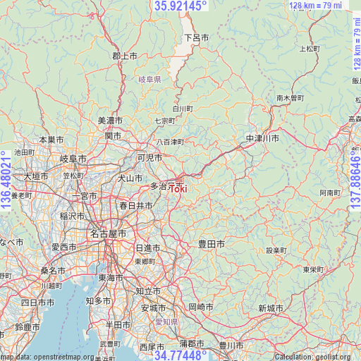
Toki GPS coordinates[2]
35° 21' 0" North, 137° 10' 59.988" East
| Map corner | latitude | longitude |
|---|---|---|
| Upper-left | 35.92145°, | 136.48021° |
| Center: | 35.35°, | 137.18333° |
| Lower-right: | 34.77448°, | 137.88646° |
| Map W x H: | 127.5×127.5 km | = 79.2×79.2mi |
| max Lat: | 45.40944° ⇑50.6% North |
| Toki: | 35.35° |
| min Lat: | ⇓49.4% South 24.34478° |
| min Long | Toki | max Long |
| 123° | 137.18333° | 145.575° |
| W 50.2%⇐ | ⇒49.8% E |
Elevation
Elevation of Toki is 159 m = 522 ft, and this is 74.4 m = 244 ft above average elevation for this country.
| Max E: |
1086 m = 3563 ft | 16.1% |
| Toki | 159 m 522 ft | |
| Avg. | 84.6 m = 278 ft | |
Min E: |
-2 m = -7 ft | 83.9% |
See also: Toki elevation on elevation.city.
Geographical zone
Toki is located in North temperate zone (between Tropic of Cancer and the Arctic Circle). Distance of this Northern Tropic circle is 1324.6 km =823.1 mi to South.| Distance of | km | miles | from Toki |
|---|---|---|---|
| North Pole | 6076.5 | 3775.8 | to North |
| Arctic Circle | 3470.6 | 2156.5 | to North |
| Tropic Cancer | 1324.6 | 823.1 | to South |
| Equator | 3930.6 | 2442.4 | to South |


Nearby cities:
15 places around Toki: (largest is in red/bold)
• Ena
21.1 km =13.1 mi,  59°
59°
• Inuyama
22 km =13.7 mi,  278°
278°
• Kakamigahara
29.6 km =18.4 mi, 284°
• Kani
13 km =8.1 mi,  297°
297°
• Kasugai
22.3 km =13.9 mi,  239°
239°
• Komaki
25.3 km =15.7 mi,  252°
252°
• Kōnan
28.5 km =17.7 mi,  265°
265°
• Minokamo
20.7 km =12.9 mi,  315°
315°
• Mitake
8.7 km =5.4 mi,  328°
328°
• Mizunami
6.3 km =3.9 mi,  72°
72°
• Nagakute
22.8 km =14.2 mi,  210°
210°
• Nisshin
26.5 km =16.5 mi, 206°
• Sekimachi
28.3 km =17.6 mi, 301°
• Seto
15 km =9.3 mi, 210°
• Tajimi
5.9 km =3.7 mi,  230°
230°
Sources, notices
• [Note1] Compared only with cities in Japan existing in our database
• [Src1] Map data: © OpenStreetMap contributors (CC-BY-SA)
• [Src2] Other city data from geonames.org with taken over terms of usage.
• [Src3] Geographical zone / Annual Mean Temperature by Robert A. Rohde @ Wikipedia
