Inuyama geodata
Inuyama (Aichi) is a seat of a second-order administrative division; located in Japan in Asia/Tokyo (GMT+9) time zone. With population of 73,995 people, there are 267 cities with bigger population in this country. Compared to other cities in Japan, 50.3% of cities are located further ↓South; 52.7% of cities are located further →East and 64.2% of cities have lower elevation than Inuyama. Note1


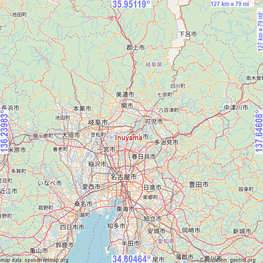
Inuyama GPS coordinates[2]
35° 22' 47.82" North, 136° 56' 34.62" East
| Map corner | latitude | longitude |
|---|---|---|
| Upper-left | 35.95119°, | 136.23983° |
| Center: | 35.37995°, | 136.94295° |
| Lower-right: | 34.80464°, | 137.64608° |
| Map W x H: | 127.5×127.5 km | = 79.2×79.2mi |
| max Lat: | 45.40944° ⇑49.7% North |
| Inuyama: | 35.37995° |
| min Lat: | ⇓50.3% South 24.34478° |
| min Long | Inuyama | max Long |
| 123° | 136.94295° | 145.575° |
| W 47.3%⇐ | ⇒52.7% E |
Elevation
Elevation of Inuyama is 56 m = 184 ft, and this is 28.6 m = 94 ft below average elevation for this country.
| Max E: |
1086 m = 3563 ft | 35.8% |
| Avg. | 84.6 m = 278 ft | |
| Inuyama | 56 m = 184 ft | |
Min E: |
-2 m = -7 ft | 64.2% |
See also: Inuyama elevation on elevation.city.
Geographical zone
Inuyama is located in North temperate zone (between Tropic of Cancer and the Arctic Circle). Distance of this Northern Tropic circle is 1328 km =825.2 mi to South.| Distance of | km | miles | from Inuyama |
|---|---|---|---|
| North Pole | 6073.2 | 3773.7 | to North |
| Arctic Circle | 3467.3 | 2154.5 | to North |
| Tropic Cancer | 1328 | 825.2 | to South |
| Equator | 3933.9 | 2444.4 | to South |


Nearby cities:
15 places around Inuyama: (largest is in red/bold)
• Gifu-shi
17.2 km =10.7 mi,  286°
286°
• Ichinomiya
15.7 km =9.8 mi,  235°
235°
• Iwakura
12.8 km =8 mi,  212°
212°
• Kakamigahara
8 km =5 mi,  300°
300°
• Kani
10.6 km =6.6 mi,  75°
75°
• Kasamatsuchō
16.1 km =10 mi,  264°
264°
• Kasugai
15 km =9.3 mi,  169°
169°
• Kitanagoya
15.9 km =9.9 mi,  201°
201°
• Komaki
11 km =6.8 mi,  192°
192°
• Kuroda
14.9 km =9.3 mi, 257°
• Kōnan
8.5 km =5.3 mi,  230°
230°
• Mino
17.2 km =10.7 mi,  352°
352°
• Minokamo
13.4 km =8.3 mi,  32°
32°
• Mitake
17.7 km =11 mi, 76°
• Sekimachi
11.7 km =7.3 mi, 348°
Sources, notices
• [Note1] Compared only with cities in Japan existing in our database
• [Src1] Map data: © OpenStreetMap contributors (CC-BY-SA)
• [Src2] Other city data from geonames.org with taken over terms of usage.
• [Src3] Geographical zone / Annual Mean Temperature by Robert A. Rohde @ Wikipedia
