Tagawa geodata
Tagawa (Fukuoka) is a seat of a second-order administrative division; located in Japan in Asia/Tokyo (GMT+9) time zone. With population of 51,608 people, there are 365 cities with bigger population in this country. Compared to other cities in Japan, 83.7% of cities are located further ↑North; 88.3% of cities are located further →East and 60.4% of cities have lower elevation than Tagawa. Note1


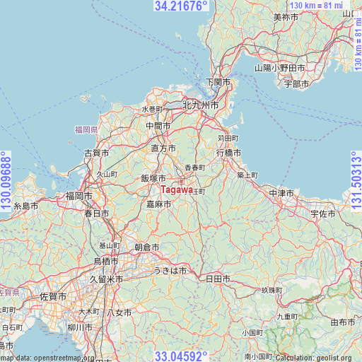
Tagawa GPS coordinates[2]
33° 37' 59.988" North, 130° 48' 0" East
| Map corner | latitude | longitude |
|---|---|---|
| Upper-left | 34.21676°, | 130.09688° |
| Center: | 33.63333°, | 130.8° |
| Lower-right: | 33.04592°, | 131.50313° |
| Map W x H: | 130.2×130.2 km | = 80.9×80.9mi |
| max Lat: | 45.40944° ⇑83.7% North |
| Tagawa: | 33.63333° |
| min Lat: | ⇓16.3% South 24.34478° |
| min Long | Tagawa | max Long |
| 123° | 130.8° | 145.575° |
| W 11.7%⇐ | ⇒88.3% E |
Elevation
Elevation of Tagawa is 46 m = 151 ft, and this is 38.6 m = 127 ft below average elevation for this country.
| Max E: |
1086 m = 3563 ft | 39.6% |
| Avg. | 84.6 m = 278 ft | |
| Tagawa | 46 m = 151 ft | |
Min E: |
-2 m = -7 ft | 60.4% |
See also: Tagawa elevation on elevation.city.
Geographical zone
Tagawa is located in North temperate zone (between Tropic of Cancer and the Arctic Circle). Distance of this Northern Tropic circle is 1133.8 km =704.5 mi to South.| Distance of | km | miles | from Tagawa |
|---|---|---|---|
| North Pole | 6267.4 | 3894.4 | to North |
| Arctic Circle | 3661.5 | 2275.1 | to North |
| Tropic Cancer | 1133.8 | 704.5 | to South |
| Equator | 3739.7 | 2323.7 | to South |


Nearby cities:
15 places around Tagawa: (largest is in red/bold)
• Amagi
27.5 km =17.1 mi,  209°
209°
• Asakura
25.5 km =15.8 mi,  197°
197°
• Iizuka
10.5 km =6.5 mi,  271°
271°
• Kama
12.2 km =7.6 mi, 206°
• Kanda
23.8 km =14.8 mi,  45°
45°
• Kawasaki
4 km =2.5 mi,  159°
159°
• Kitakyushu
24.7 km =15.3 mi,  10°
10°
• Miyata
15.9 km =9.9 mi,  301°
301°
• Miyawaka
17.4 km =10.8 mi, 302°
• Nakama
22.1 km =13.7 mi,  337°
337°
• Nōgata
13.9 km =8.6 mi,  329°
329°
• Sasaguri
23.1 km =14.4 mi, 265°
• Shiida
24 km =14.9 mi,  84°
84°
• Tsuiki
22.4 km =13.9 mi, 78°
• Yukuhashi
20 km =12.4 mi,  57°
57°
Sources, notices
• [Note1] Compared only with cities in Japan existing in our database
• [Src1] Map data: © OpenStreetMap contributors (CC-BY-SA)
• [Src2] Other city data from geonames.org with taken over terms of usage.
• [Src3] Geographical zone / Annual Mean Temperature by Robert A. Rohde @ Wikipedia
