Nakama geodata
Nakama (Fukuoka) is a seat of a second-order administrative division; located in Japan in Asia/Tokyo (GMT+9) time zone. With population of 46,745 people, there are 396 cities with bigger population in this country. Compared to other cities in Japan, 81.7% of cities are located further ↑North; 89.4% of cities are located further →East and 95.3% of cities have higher elevation than Nakama. Note1


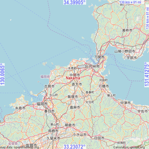
Nakama GPS coordinates[2]
33° 49' 0.768" North, 130° 42' 34.632" East
| Map corner | latitude | longitude |
|---|---|---|
| Upper-left | 34.39905°, | 130.0065° |
| Center: | 33.81688°, | 130.70962° |
| Lower-right: | 33.23072°, | 131.41275° |
| Map W x H: | 129.9×129.9 km | = 80.7×80.7mi |
| max Lat: | 45.40944° ⇑81.7% North |
| Nakama: | 33.81688° |
| min Lat: | ⇓18.3% South 24.34478° |
| min Long | Nakama | max Long |
| 123° | 130.70962° | 145.575° |
| W 10.6%⇐ | ⇒89.4% E |
Elevation
Elevation of Nakama is 3 m = 10 ft, and this is 81.6 m = 268 ft below average elevation for this country.
| Max E: |
1086 m = 3563 ft | 95.3% |
| Avg. | 84.6 m = 278 ft | |
| Nakama | 3 m = 10 ft | |
Min E: |
-2 m = -7 ft | 4.7% |
See also: Nakama elevation on elevation.city.
Geographical zone
Nakama is located in North temperate zone (between Tropic of Cancer and the Arctic Circle). Distance of this Northern Tropic circle is 1154.2 km =717.2 mi to South.| Distance of | km | miles | from Nakama |
|---|---|---|---|
| North Pole | 6247 | 3881.7 | to North |
| Arctic Circle | 3641.1 | 2262.5 | to North |
| Tropic Cancer | 1154.2 | 717.2 | to South |
| Equator | 3760.1 | 2336.4 | to South |


Nearby cities:
15 places around Nakama: (largest is in red/bold)
• Fukutsu
20.5 km =12.7 mi,  259°
259°
• Iizuka
20.2 km =12.6 mi,  186°
186°
• Kanda
25.6 km =15.9 mi,  98°
98°
• Kawasaki
26 km =16.2 mi,  158°
158°
• Kitakyushu
13.6 km =8.5 mi,  73°
73°
• Koga
24.3 km =15.1 mi,  247°
247°
• Miyata
13.2 km =8.2 mi,  203°
203°
• Miyawaka
12.8 km =8 mi,  209°
209°
• Munakata
14.1 km =8.8 mi, 260°
• Nishifukuma
22.4 km =13.9 mi, 255°
• Nōgata
8.6 km =5.3 mi,  171°
171°
• Sasaguri
26.8 km =16.7 mi, 213°
• Shimonoseki
26.7 km =16.6 mi,  56°
56°
• Tagawa
22.1 km =13.7 mi, 157°
• Yukuhashi
27.1 km =16.8 mi,  111°
111°
Sources, notices
• [Note1] Compared only with cities in Japan existing in our database
• [Src1] Map data: © OpenStreetMap contributors (CC-BY-SA)
• [Src2] Other city data from geonames.org with taken over terms of usage.
• [Src3] Geographical zone / Annual Mean Temperature by Robert A. Rohde @ Wikipedia
