Onomichi geodata
Onomichi (Hiroshima) is a seat of a second-order administrative division; located in Japan in Asia/Tokyo (GMT+9) time zone. With population of 90,936 people, there are 221 cities with bigger population in this country. Compared to other cities in Japan, 74% of cities are located further ↑North; 78.7% of cities are located further →East and 63% of cities have lower elevation than Onomichi. Note1


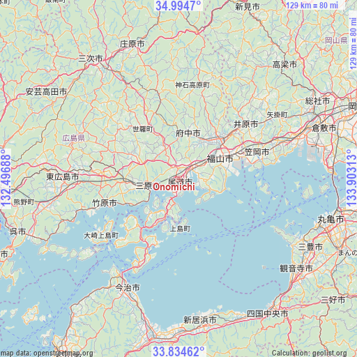
Onomichi GPS coordinates[2]
34° 25' 0.012" North, 133° 12' 0" East
| Map corner | latitude | longitude |
|---|---|---|
| Upper-left | 34.9947°, | 132.49688° |
| Center: | 34.41667°, | 133.2° |
| Lower-right: | 33.83462°, | 133.90313° |
| Map W x H: | 129×129 km | = 80.2×80.2mi |
| max Lat: | 45.40944° ⇑74% North |
| Onomichi: | 34.41667° |
| min Lat: | ⇓26% South 24.34478° |
| min Long | Onomichi | max Long |
| 123° | 133.2° | 145.575° |
| W 21.3%⇐ | ⇒78.7% E |
Elevation
Elevation of Onomichi is 52 m = 171 ft, and this is 32.6 m = 107 ft below average elevation for this country.
| Max E: |
1086 m = 3563 ft | 37% |
| Avg. | 84.6 m = 278 ft | |
| Onomichi | 52 m = 171 ft | |
Min E: |
-2 m = -7 ft | 63% |
See also: Onomichi elevation on elevation.city.
Geographical zone
Onomichi is located in North temperate zone (between Tropic of Cancer and the Arctic Circle). Distance of this Northern Tropic circle is 1220.9 km =758.6 mi to South.| Distance of | km | miles | from Onomichi |
|---|---|---|---|
| North Pole | 6180.3 | 3840.3 | to North |
| Arctic Circle | 3574.4 | 2221 | to North |
| Tropic Cancer | 1220.9 | 758.6 | to South |
| Equator | 3826.8 | 2377.9 | to South |


Nearby cities:
15 places around Onomichi: (largest is in red/bold)
• Asakuchi
39.2 km =24.4 mi,  70°
70°
• Fuchūchō
17.7 km =11 mi,  10°
10°
• Fukuyama
17 km =10.6 mi,  64°
64°
• Higashihiroshima
42.5 km =26.4 mi,  268°
268°
• Ibara
31.8 km =19.8 mi,  50°
50°
• Imabari-shi
42.7 km =26.5 mi,  205°
205°
• Innoshima
14.9 km =9.3 mi,  185°
185°
• Kamogatachō-kamogata
38.2 km =23.7 mi, 69°
• Kannabechō-yahiro
25.4 km =15.8 mi, 51°
• Kasaoka
29.6 km =18.4 mi, 70°
• Mihara
10.9 km =6.8 mi,  260°
260°
• Mitoyo
49.2 km =30.6 mi,  117°
117°
• Shin’ichi
16.8 km =10.4 mi,  23°
23°
• Shōbara
51 km =31.7 mi,  340°
340°
• Takehara
27.4 km =17 mi,  251°
251°
Sources, notices
• [Note1] Compared only with cities in Japan existing in our database
• [Src1] Map data: © OpenStreetMap contributors (CC-BY-SA)
• [Src2] Other city data from geonames.org with taken over terms of usage.
• [Src3] Geographical zone / Annual Mean Temperature by Robert A. Rohde @ Wikipedia
