Innoshima geodata
Innoshima (Hiroshima) is a populated place; located in Japan in Asia/Tokyo (GMT+9) time zone. With population of 26,141 people, there are 594 cities with bigger population in this country. Compared to other cities in Japan, 76.1% of cities are located further ↑North; 79% of cities are located further →East and 53.8% of cities have lower elevation than Innoshima. Note1


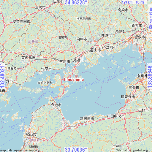
Innoshima GPS coordinates[2]
34° 16' 59.988" North, 133° 10' 59.988" East
| Map corner | latitude | longitude |
|---|---|---|
| Upper-left | 34.86228°, | 132.48021° |
| Center: | 34.28333°, | 133.18333° |
| Lower-right: | 33.70036°, | 133.88646° |
| Map W x H: | 129.2×129.2 km | = 80.3×80.3mi |
| max Lat: | 45.40944° ⇑76.1% North |
| Innoshima: | 34.28333° |
| min Lat: | ⇓23.9% South 24.34478° |
| min Long | Innoshima | max Long |
| 123° | 133.18333° | 145.575° |
| W 21%⇐ | ⇒79% E |
Elevation
Elevation of Innoshima is 33 m = 108 ft, and this is 51.6 m = 169 ft below average elevation for this country.
| Max E: |
1086 m = 3563 ft | 46.2% |
| Avg. | 84.6 m = 278 ft | |
| Innoshima | 33 m = 108 ft | |
Min E: |
-2 m = -7 ft | 53.8% |
See also: Japan elevation on elevation.city.
Geographical zone
Innoshima is located in North temperate zone (between Tropic of Cancer and the Arctic Circle). Distance of this Northern Tropic circle is 1206 km =749.4 mi to South.| Distance of | km | miles | from Innoshima |
|---|---|---|---|
| North Pole | 6195.1 | 3849.5 | to North |
| Arctic Circle | 3589.2 | 2230.2 | to North |
| Tropic Cancer | 1206 | 749.4 | to South |
| Equator | 3811.9 | 2368.6 | to South |


Nearby cities:
15 places around Innoshima: (largest is in red/bold)
• Fuchūchō
32.6 km =20.3 mi,  8°
8°
• Fukuyama
27.9 km =17.3 mi,  37°
37°
• Higashihiroshima
43.3 km =26.9 mi,  288°
288°
• Ibara
43.8 km =27.2 mi, 36°
• Imabari-shi
29.1 km =18.1 mi,  215°
215°
• Kannabechō-yahiro
37.4 km =23.2 mi, 35°
• Kan’onjichō
45.9 km =28.5 mi,  112°
112°
• Kasaoka
38.4 km =23.9 mi,  49°
49°
• Mihara
15.9 km =9.9 mi,  324°
324°
• Mitoyo
45.9 km =28.5 mi,  100°
100°
• Niihama
37.6 km =23.4 mi,  162°
162°
• Onomichi
14.9 km =9.3 mi, 5°
• Saijō
40.8 km =25.4 mi,  180°
180°
• Shin’ichi
31.4 km =19.5 mi,  15°
15°
• Takehara
25.2 km =15.7 mi,  284°
284°
Sources, notices
• [Note1] Compared only with cities in Japan existing in our database
• [Src1] Map data: © OpenStreetMap contributors (CC-BY-SA)
• [Src2] Other city data from geonames.org with taken over terms of usage.
• [Src3] Geographical zone / Annual Mean Temperature by Robert A. Rohde @ Wikipedia
