Higashihiroshima geodata
Higashihiroshima (Hiroshima) is a seat of a second-order administrative division; located in Japan in Asia/Tokyo (GMT+9) time zone. In our database, there are 767 cities with bigger population. Compared to other cities in Japan, 74.1% of cities are located further ↑North; 80.5% of cities are located further →East and 89.6% of cities have lower elevation than Higashihiroshima. Note1


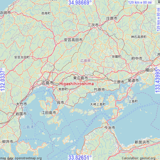
Higashihiroshima GPS coordinates[2]
34° 24' 30.996" North, 132° 44' 12.552" East
| Map corner | latitude | longitude |
|---|---|---|
| Upper-left | 34.98669°, | 132.0337° |
| Center: | 34.40861°, | 132.73682° |
| Lower-right: | 33.82651°, | 133.43995° |
| Map W x H: | 129×129 km | = 80.2×80.2mi |
| max Lat: | 45.40944° ⇑74.1% North |
| Higashihiroshima: | 34.40861° |
| min Lat: | ⇓25.9% South 24.34478° |
| min Long | Higashihiroshim | max Long |
| 123° | 132.73682° | 145.575° |
| W 19.5%⇐ | ⇒80.5% E |
Elevation
Elevation of Higashihiroshima is 217 m = 712 ft, and this is 132.4 m = 434 ft above average elevation for this country.
| Max E: |
1086 m = 3563 ft | 10.4% |
| Higashihiroshima | 217 m 712 ft | |
| Avg. | 84.6 m = 278 ft | |
Min E: |
-2 m = -7 ft | 89.6% |
See also: Japan elevation on elevation.city.
Geographical zone
Higashihiroshima is located in North temperate zone (between Tropic of Cancer and the Arctic Circle). Distance of this Northern Tropic circle is 1220 km =758.1 mi to South.| Distance of | km | miles | from Higashihiroshima |
|---|---|---|---|
| North Pole | 6181.2 | 3840.8 | to North |
| Arctic Circle | 3575.3 | 2221.6 | to North |
| Tropic Cancer | 1220 | 758.1 | to South |
| Equator | 3825.9 | 2377.3 | to South |


Nearby cities:
15 places around Higashihiroshima: (largest is in red/bold)
• Aki-takata
30 km =18.6 mi,  350°
350°
• Etajima
30.2 km =18.8 mi,  231°
231°
• Fuchūchō
49.2 km =30.6 mi,  68°
68°
• Hatsukaichi
37.6 km =23.4 mi,  260°
260°
• Hiroshima
26.3 km =16.3 mi,  267°
267°
• Hōjō
48.2 km =30 mi,  175°
175°
• Imabari-shi
44.8 km =27.8 mi,  147°
147°
• Innoshima
43.3 km =26.9 mi,  108°
108°
• Kure
25.1 km =15.6 mi,  218°
218°
• Mihara
31.8 km =19.8 mi,  91°
91°
• Miyajima
40 km =24.9 mi,  252°
252°
• Miyoshi
44.7 km =27.8 mi,  13°
13°
• Onomichi
42.5 km =26.4 mi, 88°
• Takehara
18.3 km =11.4 mi,  115°
115°
• Ōno-hara
45.4 km =28.2 mi, 252°
Sources, notices
• [Note1] Compared only with cities in Japan existing in our database
• [Src1] Map data: © OpenStreetMap contributors (CC-BY-SA)
• [Src2] Other city data from geonames.org with taken over terms of usage.
• [Src3] Geographical zone / Annual Mean Temperature by Robert A. Rohde @ Wikipedia
