Hiji geodata
Hiji (Oita) is a populated place; located in Japan in Asia/Tokyo (GMT+9) time zone. With population of 27,864 people, there are 566 cities with bigger population in this country. Compared to other cities in Japan, 86.9% of cities are located further ↑North; 84% of cities are located further →East and 55.4% of cities have higher elevation than Hiji. Note1


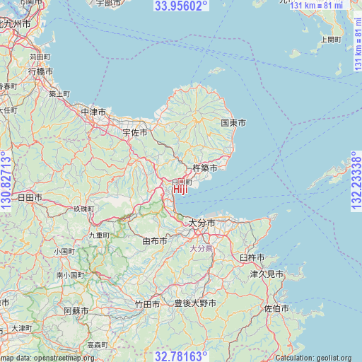
Hiji GPS coordinates[2]
33° 22' 14.916" North, 131° 31' 48.9" East
| Map corner | latitude | longitude |
|---|---|---|
| Upper-left | 33.95602°, | 130.82713° |
| Center: | 33.37081°, | 131.53025° |
| Lower-right: | 32.78163°, | 132.23338° |
| Map W x H: | 130.6×130.6 km | = 81.2×81.2mi |
| max Lat: | 45.40944° ⇑86.9% North |
| Hiji: | 33.37081° |
| min Lat: | ⇓13.1% South 24.34478° |
| min Long | Hiji | max Long |
| 123° | 131.53025° | 145.575° |
| W 16%⇐ | ⇒84% E |
Elevation
Elevation of Hiji is 23 m = 75 ft, and this is 61.6 m = 202 ft below average elevation for this country.
| Max E: |
1086 m = 3563 ft | 55.4% |
| Avg. | 84.6 m = 278 ft | |
| Hiji | 23 m = 75 ft | |
Min E: |
-2 m = -7 ft | 44.6% |
See also: Japan elevation on elevation.city.
Geographical zone
Hiji is located in North temperate zone (between Tropic of Cancer and the Arctic Circle). Distance of this Northern Tropic circle is 1104.6 km =686.4 mi to South.| Distance of | km | miles | from Hiji |
|---|---|---|---|
| North Pole | 6296.6 | 3912.5 | to North |
| Arctic Circle | 3690.7 | 2293.3 | to North |
| Tropic Cancer | 1104.6 | 686.4 | to South |
| Equator | 3710.5 | 2305.6 | to South |


Nearby cities:
15 places around Hiji: (largest is in red/bold)
• Beppu
10.6 km =6.6 mi,  196°
196°
• Bungo-Takada-shi
22.1 km =13.7 mi,  339°
339°
• Bungo-ōno
44.4 km =27.6 mi,  180°
180°
• Kitsuki
9.8 km =6.1 mi,  56°
56°
• Kunisaki
27.5 km =17.1 mi,  41°
41°
• Nakatsu
37.5 km =23.3 mi,  285°
285°
• Nakatsu
40.6 km =25.2 mi,  308°
308°
• Tsukawaki
36.3 km =22.6 mi,  253°
253°
• Tsukumiura
45.5 km =28.3 mi,  136°
136°
• Tsurusaki
20.5 km =12.7 mi,  132°
132°
• Usa
19.5 km =12.1 mi, 293°
• Usuki
37.5 km =23.3 mi, 137°
• Yoshitomi
41.7 km =25.9 mi, 308°
• Yufu
24.1 km =15 mi,  215°
215°
• Ōita
16.6 km =10.3 mi,  157°
157°
Sources, notices
• [Note1] Compared only with cities in Japan existing in our database
• [Src1] Map data: © OpenStreetMap contributors (CC-BY-SA)
• [Src2] Other city data from geonames.org with taken over terms of usage.
• [Src3] Geographical zone / Annual Mean Temperature by Robert A. Rohde @ Wikipedia
