Anan geodata
Anan (Tokushima) is a seat of a second-order administrative division; located in Japan in Asia/Tokyo (GMT+9) time zone. With population of 55,421 people, there are 347 cities with bigger population in this country. Compared to other cities in Japan, 81.3% of cities are located further ↑North; 72.4% of cities are located further →East and 69.3% of cities have higher elevation than Anan. Note1


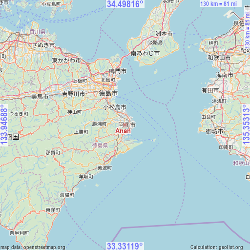
Anan GPS coordinates[2]
33° 55' 0.012" North, 134° 39' 0" East
| Map corner | latitude | longitude |
|---|---|---|
| Upper-left | 34.49816°, | 133.94688° |
| Center: | 33.91667°, | 134.65° |
| Lower-right: | 33.33119°, | 135.35313° |
| Map W x H: | 129.8×129.8 km | = 80.7×80.7mi |
| max Lat: | 45.40944° ⇑81.3% North |
| Anan: | 33.91667° |
| min Lat: | ⇓18.7% South 24.34478° |
| min Long | Anan | max Long |
| 123° | 134.65° | 145.575° |
| W 27.6%⇐ | ⇒72.4% E |
Elevation
Elevation of Anan is 12 m = 39 ft, and this is 72.6 m = 238 ft below average elevation for this country.
| Max E: |
1086 m = 3563 ft | 69.3% |
| Avg. | 84.6 m = 278 ft | |
| Anan | 12 m = 39 ft | |
Min E: |
-2 m = -7 ft | 30.7% |
See also: Anan elevation on elevation.city.
Geographical zone
Anan is located in North temperate zone (between Tropic of Cancer and the Arctic Circle). Distance of this Northern Tropic circle is 1165.3 km =724.1 mi to South.| Distance of | km | miles | from Anan |
|---|---|---|---|
| North Pole | 6235.9 | 3874.8 | to North |
| Arctic Circle | 3630 | 2255.6 | to North |
| Tropic Cancer | 1165.3 | 724.1 | to South |
| Equator | 3771.2 | 2343.3 | to South |


Nearby cities:
15 places around Anan: (largest is in red/bold)
• Arida
46.9 km =29.1 mi,  67°
67°
• Awa
38.9 km =24.2 mi,  300°
300°
• Fukura
38.4 km =23.9 mi,  9°
9°
• Gobō
48.1 km =29.9 mi,  94°
94°
• Higashikagawa
43.6 km =27.1 mi,  318°
318°
• Ishii
25.5 km =15.8 mi,  311°
311°
• Kamojimachō-jōgejima
32.3 km =20.1 mi, 301°
• Komatsushimachō
11.1 km =6.9 mi,  326°
326°
• Mima
49.5 km =30.8 mi,  288°
288°
• Minamiawaji
41.4 km =25.7 mi,  16°
16°
• Narutochō-mitsuishi
31.7 km =19.7 mi,  353°
353°
• Sumoto
52.3 km =32.5 mi, 24°
• Tokushima
18.4 km =11.4 mi,  335°
335°
• Wakimachi
49 km =30.4 mi, 289°
• Yoshinogawa
35.7 km =22.2 mi, 292°
Sources, notices
• [Note1] Compared only with cities in Japan existing in our database
• [Src1] Map data: © OpenStreetMap contributors (CC-BY-SA)
• [Src2] Other city data from geonames.org with taken over terms of usage.
• [Src3] Geographical zone / Annual Mean Temperature by Robert A. Rohde @ Wikipedia
