Nishifukuma geodata
Nishifukuma (Fukuoka) is a populated place; located in Japan in Asia/Tokyo (GMT+9) time zone. With population of 43,154 people, there are 420 cities with bigger population in this country. Compared to other cities in Japan, 82.4% of cities are located further ↑North; 92.9% of cities are located further →East and 81.8% of cities have higher elevation than Nishifukuma. Note1


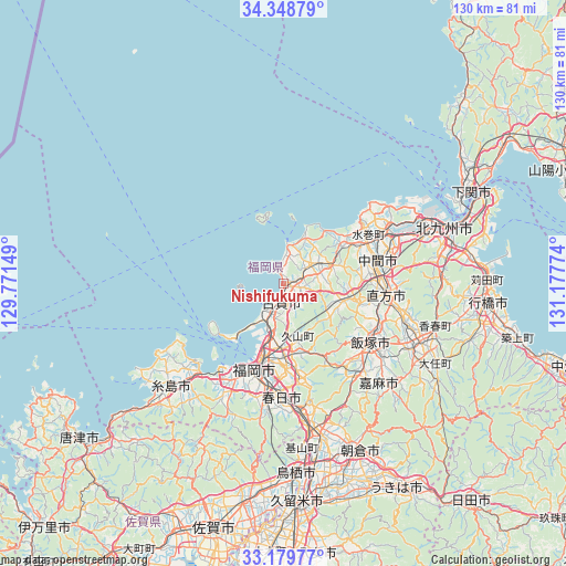
Nishifukuma GPS coordinates[2]
33° 45' 58.572" North, 130° 28' 28.596" East
| Map corner | latitude | longitude |
|---|---|---|
| Upper-left | 34.34879°, | 129.77149° |
| Center: | 33.76627°, | 130.47461° |
| Lower-right: | 33.17977°, | 131.17774° |
| Map W x H: | 130×130 km | = 80.8×80.8mi |
| max Lat: | 45.40944° ⇑82.4% North |
| Nishifukuma: | 33.76627° |
| min Lat: | ⇓17.6% South 24.34478° |
| min Long | Nishifukuma | max Long |
| 123° | 130.47461° | 145.575° |
| W 7.1%⇐ | ⇒92.9% E |
Elevation
Elevation of Nishifukuma is 7 m = 23 ft, and this is 77.6 m = 255 ft below average elevation for this country.
| Max E: |
1086 m = 3563 ft | 81.8% |
| Avg. | 84.6 m = 278 ft | |
| Nishifukuma | 7 m = 23 ft | |
Min E: |
-2 m = -7 ft | 18.2% |
See also: Nishifukuma elevation on elevation.city.
Geographical zone
Nishifukuma is located in North temperate zone (between Tropic of Cancer and the Arctic Circle). Distance of this Northern Tropic circle is 1148.5 km =713.6 mi to South.| Distance of | km | miles | from Nishifukuma |
|---|---|---|---|
| North Pole | 6252.6 | 3885.2 | to North |
| Arctic Circle | 3646.7 | 2266 | to North |
| Tropic Cancer | 1148.5 | 713.6 | to South |
| Equator | 3754.5 | 2332.9 | to South |


Nearby cities:
15 places around Nishifukuma: (largest is in red/bold)
• Dazaifu
28.6 km =17.8 mi,  170°
170°
• Fukuoka
19.2 km =11.9 mi,  196°
196°
• Fukutsu
2.4 km =1.5 mi,  39°
39°
• Iizuka
24.4 km =15.2 mi,  126°
126°
• Kasuga
26.8 km =16.7 mi,  182°
182°
• Koga
3.7 km =2.3 mi,  191°
191°
• Miyata
17.7 km =11 mi,  111°
111°
• Miyawaka
16.3 km =10.1 mi, 109°
• Munakata
8.5 km =5.3 mi,  67°
67°
• Nakama
22.4 km =13.9 mi,  75°
75°
• Nōgata
23.1 km =14.4 mi,  97°
97°
• Sasaguri
18.2 km =11.3 mi,  157°
157°
• Shingū
7.1 km =4.4 mi,  214°
214°
• Umi
22.3 km =13.9 mi, 171°
• Ōnojō
25.6 km =15.9 mi, 179°
Sources, notices
• [Note1] Compared only with cities in Japan existing in our database
• [Src1] Map data: © OpenStreetMap contributors (CC-BY-SA)
• [Src2] Other city data from geonames.org with taken over terms of usage.
• [Src3] Geographical zone / Annual Mean Temperature by Robert A. Rohde @ Wikipedia
