Shiraoi geodata
Shiraoi (Hokkaido) is a populated place; located in Japan in Asia/Tokyo (GMT+9) time zone. With population of 20,804 people, there are 680 cities with bigger population in this country. Compared to other cities in Japan, 96.1% of cities are located further ↓South; 95.2% of cities are located further ←West and 89.6% of cities have higher elevation than Shiraoi. Note1


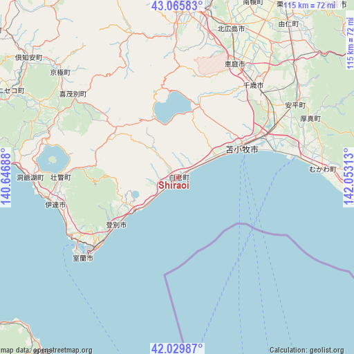
Shiraoi GPS coordinates[2]
42° 33' 0" North, 141° 21' 0" East
| Map corner | latitude | longitude |
|---|---|---|
| Upper-left | 43.06583°, | 140.64688° |
| Center: | 42.55°, | 141.35° |
| Lower-right: | 42.02987°, | 142.05313° |
| Map W x H: | 115.2×115.2 km | = 71.6×71.6mi |
| max Lat: | 45.40944° ⇑3.9% North |
| Shiraoi: | 42.55° |
| min Lat: | ⇓96.1% South 24.34478° |
| min Long | Shiraoi | max Long |
| 123° | 141.35° | 145.575° |
| W 95.2%⇐ | ⇒4.8% E |
Elevation
Elevation of Shiraoi is 5 m = 16 ft, and this is 79.6 m = 261 ft below average elevation for this country.
| Max E: |
1086 m = 3563 ft | 89.6% |
| Avg. | 84.6 m = 278 ft | |
| Shiraoi | 5 m = 16 ft | |
Min E: |
-2 m = -7 ft | 10.4% |
See also: Japan elevation on elevation.city.
Geographical zone
Shiraoi is located in North temperate zone (between Tropic of Cancer and the Arctic Circle). Distance of this Northern Tropic circle is 2125.2 km =1320.5 mi to South.| Distance of | km | miles | from Shiraoi |
|---|---|---|---|
| North Pole | 5275.9 | 3278.3 | to North |
| Arctic Circle | 2670.1 | 1659.1 | to North |
| Tropic Cancer | 2125.2 | 1320.5 | to South |
| Equator | 4731.1 | 2939.8 | to South |


Nearby cities:
15 places around Shiraoi: (largest is in red/bold)
• Chitose
38.8 km =24.1 mi,  39°
39°
• Date
40.5 km =25.2 mi,  257°
257°
• Ebetsu
64.2 km =39.9 mi,  14°
14°
• Eniwa
42.4 km =26.3 mi,  25°
25°
• Ishikari
76.7 km =47.7 mi,  0°
0°
• Iwamizawa
79.6 km =49.5 mi,  24°
24°
• Kitahiroshima
50.6 km =31.4 mi, 20°
• Muroran
39.4 km =24.5 mi,  228°
228°
• Niseko Town
61.2 km =38 mi,  294°
294°
• Noboribetsu
17.7 km =11 mi, 232°
• Otaru
76.5 km =47.5 mi,  338°
338°
• Sapporo
57.4 km =35.7 mi, 0°
• Tomakomai
22.9 km =14.2 mi,  65°
65°
• Tōbetsu
75.4 km =46.9 mi, 10°
• Yūbari
73.5 km =45.7 mi, 42°
Sources, notices
• [Note1] Compared only with cities in Japan existing in our database
• [Src1] Map data: © OpenStreetMap contributors (CC-BY-SA)
• [Src2] Other city data from geonames.org with taken over terms of usage.
• [Src3] Geographical zone / Annual Mean Temperature by Robert A. Rohde @ Wikipedia
