Nanto-shi geodata
Nanto-shi (Toyama) is a populated place; located in Japan in Asia/Tokyo (GMT+9) time zone. With population of 55,315 people, there are 348 cities with bigger population in this country. Compared to other cities in Japan, 78.4% of cities are located further ↓South; 53.3% of cities are located further →East and 69.4% of cities have lower elevation than Nanto-shi. Note1


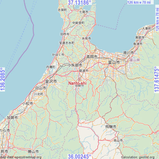
Nanto-shi GPS coordinates[2]
36° 34' 9.192" North, 136° 54' 41.832" East
| Map corner | latitude | longitude |
|---|---|---|
| Upper-left | 37.13186°, | 136.2085° |
| Center: | 36.56922°, | 136.91162° |
| Lower-right: | 36.00245°, | 137.61475° |
| Map W x H: | 125.6×125.6 km | = 78×78mi |
| max Lat: | 45.40944° ⇑21.6% North |
| Nanto-shi: | 36.56922° |
| min Lat: | ⇓78.4% South 24.34478° |
| min Long | Nanto-shi | max Long |
| 123° | 136.91162° | 145.575° |
| W 46.7%⇐ | ⇒53.3% E |
Elevation
Elevation of Nanto-shi is 70 m = 230 ft, and this is 14.6 m = 48 ft below average elevation for this country.
| Max E: |
1086 m = 3563 ft | 30.6% |
| Avg. | 84.6 m = 278 ft | |
| Nanto-shi | 70 m = 230 ft | |
Min E: |
-2 m = -7 ft | 69.4% |
See also: Nanto-shi elevation on elevation.city.
Geographical zone
Nanto-shi is located in North temperate zone (between Tropic of Cancer and the Arctic Circle). Distance of this Northern Tropic circle is 1460.2 km =907.3 mi to South.| Distance of | km | miles | from Nanto-shi |
|---|---|---|---|
| North Pole | 5940.9 | 3691.5 | to North |
| Arctic Circle | 3335.1 | 2072.3 | to North |
| Tropic Cancer | 1460.2 | 907.3 | to South |
| Equator | 4066.1 | 2526.6 | to South |


Nearby cities:
15 places around Nanto-shi: (largest is in red/bold)
• Fukumitsu
4 km =2.5 mi,  250°
250°
• Hakusan
30.6 km =19 mi, 251°
• Imizu
29.2 km =18.1 mi,  40°
40°
• Kahoku
27.5 km =17.1 mi,  319°
319°
• Kanazawa
26.6 km =16.5 mi,  277°
277°
• Nanto
6.5 km =4 mi,  194°
194°
• Nishishinminato
27.6 km =17.1 mi,  32°
32°
• Nonoichi
26.6 km =16.5 mi,  261°
261°
• Oyabe
12.2 km =7.6 mi,  333°
333°
• Takaoka
22.2 km =13.8 mi,  24°
24°
• Tonami
6.4 km =4 mi, 26°
• Toyama
30.9 km =19.2 mi,  61°
61°
• Tsubata
19 km =11.8 mi,  306°
306°
• Tsurugi-asahimachi
28.2 km =17.5 mi,  241°
241°
• Yatsuomachi-higashikumisaka
19.8 km =12.3 mi,  90°
90°
Sources, notices
• [Note1] Compared only with cities in Japan existing in our database
• [Src1] Map data: © OpenStreetMap contributors (CC-BY-SA)
• [Src2] Other city data from geonames.org with taken over terms of usage.
• [Src3] Geographical zone / Annual Mean Temperature by Robert A. Rohde @ Wikipedia
