Yatsuomachi-higashikumisaka geodata
Yatsuomachi-higashikumisaka (Toyama) is a populated place; located in Japan in Asia/Tokyo (GMT+9) time zone. With population of 22,205 people, there are 657 cities with bigger population in this country. Compared to other cities in Japan, 78.3% of cities are located further ↓South; 50.4% of cities are located further →East and 87.9% of cities have lower elevation than Yatsuomachi-higashikumisaka. Note1
Current local time in Yatsuomachi-higashikumisaka:
10:22 AM, SundayDifference from your time zone: hours


Yatsuomachi-higashikumisaka GPS coordinates[2]
36° 34' 0.012" North, 137° 7' 59.988" East
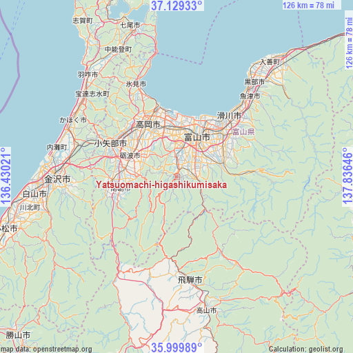
| Map corner | latitude | longitude |
|---|---|---|
| Upper-left | 37.12933°, | 136.43021° |
| Center: | 36.56667°, | 137.13333° |
| Lower-right: | 35.99989°, | 137.83646° |
| Map W x H: | 125.6×125.6 km | = 78×78mi |
| max Lat: | 45.40944° ⇑21.7% North |
| Yatsuomachi-higashikumisaka: | 36.56667° |
| min Lat: | ⇓78.3% South 24.34478° |
| min Long | Yatsuomachi-hig | max Long |
| 123° | 137.13333° | 145.575° |
| W 49.6%⇐ | ⇒50.4% E |
Elevation
Elevation of Yatsuomachi-higashikumisaka is 197 m = 646 ft, and this is 112.4 m = 369 ft above average elevation for this country.
| Max E: |
1086 m = 3563 ft | 12.1% |
| Yatsuomachi-higashikumisaka | 197 m 646 ft | |
| Avg. | 84.6 m = 278 ft | |
Min E: |
-2 m = -7 ft | 87.9% |
See also: Japan elevation on elevation.city.
Geographical zone
Yatsuomachi-higashikumisaka is located in North temperate zone (between Tropic of Cancer and the Arctic Circle). Distance of this Northern Tropic circle is 1459.9 km =907.1 mi to South.| Distance of | km | miles | from Yatsuomachi-higashikumisaka |
|---|---|---|---|
| North Pole | 5941.2 | 3691.7 | to North |
| Arctic Circle | 3335.3 | 2072.5 | to North |
| Tropic Cancer | 1459.9 | 907.1 | to South |
| Equator | 4065.8 | 2526.4 | to South |


Nearby cities:
15 places around Yatsuomachi-higashikumisaka: (largest is in red/bold)
• Fukumitsu
23.6 km =14.7 mi,  267°
267°
• Hida
36 km =22.4 mi,  174°
174°
• Himi
33.9 km =21.1 mi,  336°
336°
• Himimachi
34.7 km =21.6 mi, 338°
• Imizu
22.4 km =13.9 mi,  358°
358°
• Kamiichi
25.6 km =15.9 mi,  54°
54°
• Namerikawa
29.6 km =18.4 mi,  43°
43°
• Nanto
22.2 km =13.8 mi,  254°
254°
• Nanto-shi
19.8 km =12.3 mi, 270°
• Nishishinminato
24.2 km =15 mi,  347°
347°
• Oyabe
27.6 km =17.1 mi,  293°
293°
• Takaoka
22.9 km =14.2 mi,  332°
332°
• Tonami
18 km =11.2 mi, 289°
• Toyama
16.6 km =10.3 mi,  26°
26°
• Uozu
35.2 km =21.9 mi, 42°
Sources, notices
• [Note1] Compared only with cities in Japan existing in our database
• [Src1] Map data: © OpenStreetMap contributors (CC-BY-SA)
• [Src2] Other city data from geonames.org with taken over terms of usage.
• [Src3] Geographical zone / Annual Mean Temperature by Robert A. Rohde @ Wikipedia
