Miyoshi geodata
Miyoshi (Tokushima) is a seat of a second-order administrative division; located in Japan in Asia/Tokyo (GMT+9) time zone. In our database, there are 767 cities with bigger population. Compared to other cities in Japan, 81.1% of cities are located further ↑North; 75.4% of cities are located further →East and 99.8% of cities have lower elevation than Miyoshi. Note1


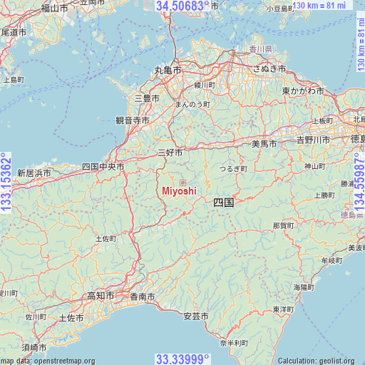
Miyoshi GPS coordinates[2]
33° 55' 31.476" North, 133° 51' 24.264" East
| Map corner | latitude | longitude |
|---|---|---|
| Upper-left | 34.50683°, | 133.15362° |
| Center: | 33.92541°, | 133.85674° |
| Lower-right: | 33.33999°, | 134.55987° |
| Map W x H: | 129.7×129.7 km | = 80.6×80.6mi |
| max Lat: | 45.40944° ⇑81.1% North |
| Miyoshi: | 33.92541° |
| min Lat: | ⇓18.9% South 24.34478° |
| min Long | Miyoshi | max Long |
| 123° | 133.85674° | 145.575° |
| W 24.6%⇐ | ⇒75.4% E |
Elevation
Elevation of Miyoshi is 905 m = 2969 ft, and this is 820.4 m = 2692 ft above average elevation for this country.
| Max E: |
1086 m = 3563 ft | 0.2% |
| Miyoshi | 905 m 2969 ft | |
| Avg. | 84.6 m = 278 ft | |
Min E: |
-2 m = -7 ft | 99.8% |
See also: Japan elevation on elevation.city.
Geographical zone
Miyoshi is located in North temperate zone (between Tropic of Cancer and the Arctic Circle). Distance of this Northern Tropic circle is 1166.2 km =724.6 mi to South.| Distance of | km | miles | from Miyoshi |
|---|---|---|---|
| North Pole | 6234.9 | 3874.2 | to North |
| Arctic Circle | 3629 | 2255 | to North |
| Tropic Cancer | 1166.2 | 724.6 | to South |
| Equator | 3772.2 | 2343.9 | to South |


Nearby cities:
15 places around Miyoshi: (largest is in red/bold)
• Awa
43.6 km =27.1 mi,  64°
64°
• Ikedachō
12.4 km =7.7 mi,  337°
337°
• Kami
26.9 km =16.7 mi,  182°
182°
• Kan’onji
25 km =15.5 mi,  309°
309°
• Kan’onjichō
29.7 km =18.5 mi,  319°
319°
• Kawanoechō
27.6 km =17.1 mi,  291°
291°
• Kōnan
38.6 km =24 mi,  190°
190°
• Marugame
40.4 km =25.1 mi,  350°
350°
• Mima
29.8 km =18.5 mi, 61°
• Mitoyo
35.9 km =22.3 mi,  332°
332°
• Shikokuchūō
28.9 km =18 mi,  281°
281°
• Tadotsu
40.1 km =24.9 mi, 345°
• Wakimachi
31.3 km =19.4 mi, 59°
• Yoshinogawa
42.1 km =26.2 mi,  72°
72°
• Zentsujichó
34.3 km =21.3 mi, 347°
Sources, notices
• [Note1] Compared only with cities in Japan existing in our database
• [Src1] Map data: © OpenStreetMap contributors (CC-BY-SA)
• [Src2] Other city data from geonames.org with taken over terms of usage.
• [Src3] Geographical zone / Annual Mean Temperature by Robert A. Rohde @ Wikipedia
